Ben Vrackie from Moulin (Pitlochry)
Perth and Kinross Walk
County/Area - Perth and Kinross
Author - Lou Johnson
Length - 5.0 miles / 8.1 km Ascent - 2200 feet / 667 metres
Time - 4 hours 40 minutes Grade - moderate
Walk Route Description
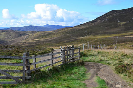
Click image to see photo description.
This walk climbs to the summit of Ben Vrackie (841 m.) from Moulin on the northern outskirts of Pitlochry. Ben Vrackie lies just south of the Cairngorm National Park. The route follows a clear and well-maintained path which is used by most walkers visiting the summit, which offers extensive views as far as Rannoch Moor and the Glencoe area.
The start is the upper car park (grid ref. NN994598) which is signed from the Moulin Hotel just to the north of Pitlochry. On busy days you may need to use the lower car park. The route which is signed from the car park and at intermediate path junctions heads north through pleasant woodland initially following Moulin Burn.
Reaching open hillside, you pass a notice reminding you to be properly equipped for this mountain walk. Note that as with many hill walks the weather can change quickly. The onward path crosses heather moors gaining height steadily. Reaching the junction with the Bealach Path (grid ref. NN943614), bear right here and continue up to a bealach between the minor summits of Creag Bhreac on your right and Stac an Fheidh on your left.
After the bealach you lose a little height before continuing to climb past Loch a' Choire. After crossing the dam, the gradient steepens, and the hard work begins. The path is good, and you climb quickly with the southern flank of Ben Vrackie ahead. Eventually the path curves left, and the summit is nearby. Continue the short distance to the summit and enjoy the views. The summit area is adorned with an OS trig column and a topograph which details the landmarks visible from the summit.
The descent route follows the path used to reach the summit. However, a worthwhile diversion is to bear left off the main path shortly after leaving the summit to a cairn from where a different perspective of the view can be enjoyed.
Maps 

| Ordnance Survey Explorer OL49 | Sheet Map | 1:25k | BUY |
| Anquet OS Explorer OL49 | Digital Map | 1:25k | BUY |
| Ordnance Survey Digital Map Subscription | |||
| Latest Ordnance Survey Discounts | |||
Other walks nearby
| Walk 3754 | Ben Vrackie & Meall an Daimh from Pitlochry | mod/hard | 8.0 miles |
| Walk 3354 | Glen Banvie and Blair Castle from the Falls of Bruar | moderate | 11.3 miles |
| Walk 1046 | Schiehallion via main path | moderate | 6.4 miles |
| Walk 2356 | The Cairnwell ridge from Glenshee Ski Centre | mod/hard | 9.3 miles |
| Walk 1119 | Ben Macdui & Carn a' Mhaim | hard | 19.0 miles |
| Walk 1968 | Loch Turret to Comrie | easy/mod | 8.0 miles |
| Walk 3747 | Ben Chonzie from Loch Turret | mod/hard | 10.0 miles |
| Walk 1864 | Glen Quoich & Glen Lui (near Braemar) | moderate | 10.0 miles |
| Walk 3108 | Creag Choinnich circular | easy/mod | 4.0 miles |
| Walk 2706 | Morrone (Morven) | moderate | 7.4 miles |
