Warlaw Pike & Birkside Fell from Blanchland
North Pennines Walk
Region - North Pennines
County/Area - Northumberland County
Author - Lou Johnson
Length - 8.0 miles / 13 km Ascent - 850 feet / 258 metres
Time - 4 hours 50 minutes Grade - moderate
Maps 

| Ordnance Survey Explorer OL43 | Sheet Map | 1:25k | BUY |
| Anquet OS Explorer OL43 | Digital Map | 1:25k | BUY |
| Ordnance Survey Landranger 87 | Sheet Map | 1:50k | BUY |
| Anquet OS Landranger 87 | Digital Map | 1:50k | BUY |
Walk Route Description
Click image to visit gallery of 6 images.
The moors between Weardale and Tynedale, although lacking in dramatic summits, do offer excellent walking. This undemanding route starts from the picturesque village of Blanchland in Derwentdale and climbs steadily onto the moors. Using tracks and paths the walk then crosses Blanchland Moor to the edge of Slaley Forest before returning across Bulbeck Common and Birkside Fell to the start.
There is a free car park on the north side of Blanchland village (Grid ref. NY964504). After parking turn left out of the exit and start the climb up to the hamlet of Shildon. Continue straight ahead on the lane climbing easily to reach Pennypie House. Stay on the main track bearing right to continue with a wall on your right to a gate (Grid ref. NY950522). Go through the gate and follow the clear track across Blanchland Moor. As you crest the brow of the hill, you will be rewarded in good weather with views as far north as the Cheviot. Stay on the main track descending towards Slaley Forest. At grid ref. NY952542 you pass a track on the left hand side leading to a quarry. Ignore this and continue for another 600 metres towards the edge of the forest and take the track on the left (grid ref. NY952545). Follow this for a short way soon bearing right into the plantation. The track bears to the left and continues in a west-south-west direction through the trees emerging into an open area (grid ref. NY947543).
As this track bends to the right, take the narrower track on the left which leads to a gate (grid ref. NY944540). Turn left and follow the track alongside the fence for just over 100 metres and turn right. With the fence on your left, walk on a feint path south-west to reach a sunken track all but buried in heather. This is the Carrier's Way passing the trig point on Warlaw Pike to your left. A narrow path follows the sunken track across the moor with improving views to your right across Devil's Water Dale. Continuing across Bulbeck Common you reach a path junction at Embleyburn Head (Grid ref. NY941533). Go straight ahead here and do the same at a more complex junction of paths and tracks at grid reference NY936525) staying with the Carrier's Way to reach a wall (Grid ref. NY936521). The onward route has been realigned and older OS maps show the old route. There are new waymarks in place and these should be followed to reach the new path junction at grid reference NY936517 where you bear left across Birkside Fell.
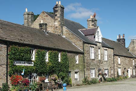
The waymarking is generally clear although a couple of posts have toppled into the heather so you need to keep walking generally south east to reach a wall above Birkside (Grid ref. NY947510). Keeping the wall on your right continue to the track junction by Stothill Plantation (Grid ref. NY952508). Turn right here and descend down the lane to Baybridge. Reaching the main valley road cross over and take the recently constructed path (2006) that runs parallel with the road back to Blanchland village. Before returning to the car allow time to explore this very picturesque stone built village with its wonderfully quaint post office.
Other walks nearby
| Walk 2815 | Pennypie and Blanchland from Baybridge | easy/mod | 3.8 miles |
| Walk 2089 | College Edge & Cuthbert's Currick from Edmundbyers | easy/mod | 8.0 miles |
| Walk 1942 | Watson's Pike & Hexhamshire Common | easy/mod | 6.0 miles |
| Walk 2382 | Smiddy Shaw Reservoir Circular | easy/mod | 6.2 miles |
| Walk 2393 | Weardale Circular from Westgate | easy/mod | 6.4 miles |
| Walk 1987 | Allendale Town Circular | easy/mod | 6.6 miles |
| Walk 3634 | Catterick Moss & Bollihope Carrs | moderate | 5.6 miles |
| Walk 1659 | Race Head & Sedling Rake from Wearhead | easy/mod | 6.0 miles |
| Walk 1948 | Tunstall Reservoir | easy/mod | 7.3 miles |
| Walk 1955 | Sunnyside Edge from Wolsingham | easy/mod | 7.5 miles |
Recommended Books & eBooks
Walking in Northumberland
 This guidebook contains detailed route descriptions for 36 day walks in Northumberland including the Cheviot Hills. The terrain varies from wild walks and craggy ascents to gentle riverside strolls. Each route ranges from 4 to 16 miles in length and there is the opportunity to link several walks together to create longer treks.
More information
Hadrian's Wall Path
 Hadrians Wall Path guidebook to walk the 84 mile National Trail. Described in both directions, the main description is west to east between Bowness-on-Solway and Wallsend, Newcastle, with extensions to Maryport and South Shields. With extensive historical information related to this World Heritage site and separate 1:25,000 OS map booklet included.
More information
Messaging & Social Media
Message Walking Britain and follow the latest news.

Mountain Weather
Stay safe on the mountains with detailed weather forecasts - for iOS devices or for Android devices.