Bala Walks and Walking Guide
Snowdonia, Gwynedd
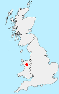
Find circular walks near Bala which is located on the eastern edge of the Snowdonia National Park. The town has a wide range of local amenities including cafés, bars and restaurants. Accommodation including camp sites and caravan parks is readily available. Public transport is limited and most of the walks listed below require the use of private transport.
All walks are free to download and print, and all routes have mapping and GPX files. Bala occupies an excellent position to explore other parts of the National Park. The Arans, Arenigs and Berwyn Hills are relatively close by with many excellent walks to be enjoyed. Further afield highlights include the Precipice Walk near Dolgellau and the rugged Rhinog mountains. Closer to the town are a number of easier routes in the hills surrounding Lake Bala.
★ = GPS file available
| Walk | Description | Grade | Miles |
|---|---|---|---|
| 2059★ | Castell Carndochan near Bala | easy/mod | 2.50 |
| 1646★ | The Precipice Walk from near Dolgellau | easy | 3.50 |
| 3055★ | Glasgwm from Cwm Cywarch | moderate | 4.50 |
| 1151★ | Moel Siabod from Pont Cyfyng | hard | 5.50 |
| 2551★ | Rhobell Fawr from near Rhydymain | moderate | 5.70 |
| 2055★ | Moel Emoel from near Bala | moderate | 6.00 |
| 1037★ | Two lakes of the Gwydir Forest - Llyn Elsi and Llyn Parc from Betws-y-Coed | easy/mod | 6.50 |
| 1332★ | Gwydir ForestLakes from Tyn Llwyn | easy/mod | 6.50 |
| 1086★ | Post Gwyn and Craig-y-Mwn from Pistyll Rhaeadr | moderate | 6.50 |
| 1190★ | Aran Fawddwy from Cwm Cywarch | mod/hard | 7.50 |
| 2302★ | Arenig Fawr from Arenig near Llyn Celyn | moderate | 8.00 |
| 2544★ | Rhinog Fach circular from Coed y Brenin | moderate | 8.00 |
| 1334★ | Cnicht from Tanygrisiau | moderate | 8.00 |
| 2937★ | Aran Fawddwy northern approach from Esgair-gawr farm | mod/hard | 8.40 |
| 3024★ | North West of Blaenau Ffestiniog from Crimea Pass | mod/hard | 8.50 |
| 2811★ | Rhobell Fawr and Ddualt from near Rhydymain | moderate | 8.50 |
| 3102★ | Bwlch Sych and Tynygarreg from Lake Vyrnwy | moderate | 8.50 |
| 1036★ | Rhinog Fach & Y Llethr from Craigddu Isaf | moderate | 9.00 |
| 3031★ | Cadair Berwyn from Cwm Maen Gwynedd | moderate | 9.25 |
| 1256★ | Cadair Bronwen from Llandrillo | moderate | 9.50 |
| 3017★ | Aran Benllyn & Aran Fawddwy from Llanuwchllyn | mod/hard | 10.00 |
| 1107★ | Waun Oer and Maesglase near Dinas Mawddwy | mod/hard | 11.00 |
| 1255★ | The Aran Ridge from Cwm Cywarch | hard | 11.20 |
| 1499★ | Rhobell Fawr and Dduallt from Llanfachreth | moderate | 12.00 |
| 1400★ | The Arans from Cwm Cywarch | hard | 14.00 |
| 2713★ | Traverse of the Northern Rhinogs from Trawsfynydd | mod/hard | 14.00 |
| 3053★ | Berwyn Tops from Tan Y Pystyll | moderate | 14.00 |
| 3227★ | Rhinog Fawr and tarns from Bronaber | mod/hard | 15.00 |
The walks listed above are the nearest 30 from Bala when measured in a straight line.
Recommended Reading
Snowdonia: 30 Low-level and easy walks - North
 Guidebook describing 30 walks in Snowdonia, Wales. Routes are mostly low level and on clear paths and showcase the region's beautiful scenery and rich history and culture. Part of a 2-volume set, this northern volume includes the Snowdon area, the Ogwen and Conwy Valleys, Betws-y-Coed, Beddgelert, Ffestiniog and the coast.
More information
The Wales Coast Path
 A single guidebook to walking the whole Wales Coast Path - 1400km (870 miles) the length of Wales from Chester to Chepstow, including Anglesey, described in 57 stages. The route passes through the Snowdonia and Pembrokeshire National Parks and many AONBs and can be linked with the Offa's Dyke Path for a complete circuit of Wales.
More information
Further Information
Walk Location Map
Walking in Snowdonia
Walking in TSnowdonia (Eryri) National Park is much more than the highest mountain in England and Wales. Mainly mountainous, it encompasses a large area of beautiful and often spectacular wild landscapes. Located in North Wales, the National Park offers a tremendous variety of walks with many challenging mountain routes. More Information
Walk grading - Learn how each walk is assessed and select a walk to suit your ability and experience by going to Walk Grading Details.
Messaging & Social Media
Message Walking Britain and follow the latest news.

Mountain Weather
Stay safe on the mountains with detailed weather forecasts - for iOS devices or for Android devices.