Hawes Walks and Walking Guide
Yorkshire Dales, North Yorkshire
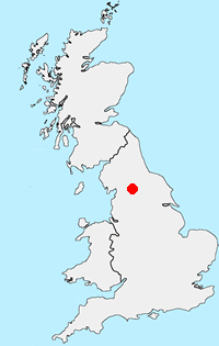
Find circular walks near Hawes which is a bustling market town and well situated to visit Wensleydale, Swaledale, Upper Wharfdale and Ribblesdale in the Yorkshire Dales National Park. The town has excellent amenities including cafés, bars and restaurants. Accommodation in the area is varied including campsites and caravan parks. Public transport is limited and private transport is recommended to undertake the walks listed below. Highlights include the 'Three Peaks' of Ingleborough, Whenside and Pen-y-ghent, beautiful Swaledale, glorious Upper Wharfdale and the valley Mallerstang just outside the National Park boundaries.
All walks are free to download and print, and all routes have mapping and GPX files. Many of the routes offer excellent hill walking. However, family circular walks are available but less numerous.
★ = GPS file available
| Walk | Description | Grade | Miles |
|---|---|---|---|
| 1383★ | Pendragon Castle from Outhgill | easy | 2.25 |
| 3093★ | Bunton Hush, Blakethwaite & Gunnerside Gill | easy/mod | 5.50 |
| 1252★ | Great Pinseat from Surrender Bridge | easy/mod | 5.50 |
| 3524★ | Semer Water and Cam High Road from Bainbridge | easy/mod | 5.70 |
| 1694★ | Nappa Hall & Whitfield Gill Force from Askrigg | easy/mod | 6.00 |
| 3233★ | Dent & Gawthrop | easy/mod | 6.00 |
| 1341★ | Nine Standards Rigg from Birk Dale | moderate | 6.00 |
| 1680★ | Haw Lane & Aysgarth Moor from Aysgarth | easy/mod | 6.30 |
| 1278★ | Cosh & Foxup from Halton Gill | easy/mod | 6.50 |
| 1340★ | Muker & Upper Swaledale from Keld | easy/mod | 6.50 |
| 1013★ | Pen-y-ghent from Horton-in-Ribblesdale | moderate | 6.50 |
| 1160★ | Wild Boar Fell & Swarth Fell from Cotegill Bridge | moderate | 7.00 |
| 1208★ | Ingleborough & Park Fell from Chapel-le-Dale | moderate | 7.50 |
| 1254★ | Yockenthwaite & Hubberholme from Buckden | moderate | 8.00 |
| 3340★ | Blea Moor & Denthead from Ribblehead | moderate | 8.20 |
| 2132★ | Buckden Pike and Hubberholme from Buckden | moderate | 8.40 |
| 1053★ | Swinner Gill and Muker from Thwaite | mod/hard | 8.50 |
| 1197★ | Gunnerside & Swinner Gills | moderate | 8.50 |
| 1384★ | Mallerstang Edge from Aisgill Moor | moderate | 8.75 |
| 1121★ | Pen-y-ghent & Plover Hill from Horton in Ribblesdale | moderate | 9.00 |
| 3500★ | Ingleborough (northern approach) from Chapel-le-Dale | moderate | 9.50 |
| 1055★ | Penhill & West Burton from Aysgarth Falls | moderate | 10.00 |
| 1056★ | Gunnerside & Surrender Bridge | moderate | 10.25 |
| 1281★ | Buckden Pike from Buckden | moderate | 10.50 |
| 1184★ | Whernside & Scales Moor from Ribblehead | moderate | 11.00 |
| 1052★ | Whernside & Dentdale from Dent | mod/hard | 12.00 |
| 2409★ | The Upper Eden valley without a car | moderate | 12.00 |
| 3135★ | Dentdale & Bleamoor | moderate | 12.50 |
| 2822★ | Aysgarth & Castle Bolton from Askrigg | mod/hard | 14.50 |
| 1926★ | Pen-y-ghent & Littondale from Litton | hard | 16.00 |
The walks listed above are the nearest 30 from Hawes when measured in a straight line.
Recommended Reading
Trail and Fell Running in the Yorkshire Dales
 Guidebook to 40 of the best trail and fell runs in the Yorkshire Dales National Park. Ranging from 5 to 24 miles, the graded runs start from bases such as Ribblehead, Dent, Sedbergh, Malham and Grassington and take in the region's diverse delights, from castles and waterfalls to iconic mountains such as Whernside, Ingleborough and Pen Y Ghent.
More information
Further Information
Walk Location Map
Walking in Yorkshire Dales
Walking in the Yorkshire Dales National Park covers an extensive area, which contains a wide variety of scenic interest. Each Dale is usually named after its river although there are a few examples that don't follow this rule. The varied underlying geology is reflected in the scenery with limestone and gritstone the prominent rocks resulting in virtually every type of scenery from dry valleys to wild moorland. More Information
Walk grading - Learn how each walk is assessed and select a walk to suit your ability and experience by going to Walk Grading Details.
Messaging & Social Media
Message Walking Britain and follow the latest news.

Mountain Weather
Stay safe on the mountains with detailed weather forecasts - for iOS devices or for Android devices.