Llanberis Walks and Walking Guide
Snowdonia, Gwynedd
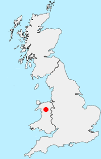
Find circular walks near Llanberis which lies at the foot of Snowdon and is an excellent base for walking in this area. There are excellent local amenities including cafés, bars and restaurants. Accommodation including camp sites and caravan parks is readily available. Public transport is good in season with the Snowdon Sherpa bus service providing links to many of the walks listed below.
All walks are free to download and print, and all routes have napping and GPX files. Highlights include an ascent of Snowdon including the challenging route over Crib Goch. Walks into the Glyders are also possible and these provide quieter alternatives to the approaches from the Ogwen Valley. The Nantlle Ridge is a great walk and one of the best in Snowdonia.
★ = GPS file available
| Walk | Description | Grade | Miles |
|---|---|---|---|
| 1131★ | Mynydd Mawr & Fron | easy/mod | 4.00 |
| 2122★ | Cwm Glas from Pen-y-pass | mod/hard | 4.00 |
| 1454★ | Glyder Fawr & Glyder Fach from Pen-y-Pass | mod/hard | 5.50 |
| 1136★ | Yr Aran (Route 2) from Bethania | moderate | 5.50 |
| 1951★ | Mynydd Mawr from Rhyd-Ddu | moderate | 6.00 |
| 1453★ | Elidir Fawr, Mynydd Perfedd & Marchlyn Mawr reservoir | moderate | 6.00 |
| 2590★ | Nantlle Ridge Walk from Rhyd Ddu (Route A) | moderate | 6.00 |
| 3073★ | Crib Goch, Garnedd Ugain and Snowdon from Pen-y-pass | hard | 6.50 |
| 1192★ | Yr Aran from Bethania | mod/hard | 6.50 |
| 3057★ | Moel Eilio from Llanberis | moderate | 7.00 |
| 1958★ | The Snowdon Horseshoe from Pen-y-pass | hard | 7.50 |
| 1216★ | Y Lliwedd & Snowdon from Pen-y-pass | mod/hard | 7.50 |
| 1418★ | Snowdon and Y Lliwedd from Pen-y-pass | mod/hard | 7.50 |
| 3198★ | Snowdon via the South Ridge & Rhyd-ddu Path | mod/hard | 7.50 |
| 2729★ | Snowdon by Rhyd-Ddu and Snowdon Ranger Paths | mod/hard | 7.50 |
| 1089★ | Snowdon by the Pyg and Miner's Tracks from Pen-y-pass | moderate | 7.50 |
| 2692★ | Snowdon via Dinas Mot & Crib Goch from Pen-y-pass | hard | 8.00 |
| 2290★ | Snowdon via the Watkin Path & South Ridge from Bethania | mod/hard | 8.00 |
| 2797★ | Yr Aran and Snowdon from Rhyd-Ddu | mod/hard | 8.50 |
| 3036★ | Snowdon via Crib Goch from Pen-y-pass | very hard | 8.50 |
| 1003★ | Snowdon by the Llanberis Path from Llanberis | moderate | 9.00 |
| 2626★ | Snowdon & Garnedd Ugain from Llanberis | moderate | 9.30 |
| 1681★ | Moel Eilio & Moel Cynghorion from Llanberis | mod/hard | 10.00 |
| 1103★ | Snowdon & Cwm Llan horseshoe | very hard | 13.00 |
| 3059★ | Moel Cynghorion & Snowdon from near Llanberis | very hard | 13.50 |
The walks listed above are the nearest 25 from Llanberis when measured in a straight line.
Recommended Reading
Snowdonia: 30 Low-level and easy walks - North
 Guidebook describing 30 walks in Snowdonia, Wales. Routes are mostly low level and on clear paths and showcase the region's beautiful scenery and rich history and culture. Part of a 2-volume set, this northern volume includes the Snowdon area, the Ogwen and Conwy Valleys, Betws-y-Coed, Beddgelert, Ffestiniog and the coast.
More information
Snowdonia: 30 Low-level and easy walks - South
 Guidebook describing 30 walks in Snowdonia, Wales. Routes are mostly low level and on clear paths and showcase the region's beautiful scenery and rich history and culture. Part of a 2-volume set, this southern volume includes Trawsfynydd, Bala, Dolgellau, Machynlleth, the Harlech Coast and the valleys of the Mawddach and Dyfi.
More information
Further Information
Walk Location Map
Walking in Snowdonia
Walking in TSnowdonia (Eryri) National Park is much more than the highest mountain in England and Wales. Mainly mountainous, it encompasses a large area of beautiful and often spectacular wild landscapes. Located in North Wales, the National Park offers a tremendous variety of walks with many challenging mountain routes. More Information
Walk grading - Learn how each walk is assessed and select a walk to suit your ability and experience by going to Walk Grading Details.
Messaging & Social Media
Message Walking Britain and follow the latest news.

Mountain Weather
Stay safe on the mountains with detailed weather forecasts - for iOS devices or for Android devices.