Cannock Chase Circular from Milford
Cannock Chase Walk
Region - Cannock Chase
County/Area - Staffordshire - Cannock Chase
Author - Lou Johnson
Length - 6.5 miles / 10.6 km Ascent - 250 feet / 76 metres
Time - 3 hours 30 minutes Grade - easy
Maps 

| Ordnance Survey Explorer 244 | Sheet Map | 1:25k | BUY |
| Anquet OS Explorer 244 | Digital Map | 1:25k | BUY |
| Ordnance Survey Landranger 127 | Sheet Map | 1:50k | BUY |
| Anquet OS Landranger 127 | Digital Map | 1:50k | BUY |
Walk Route Description
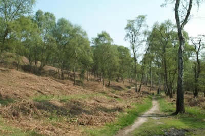
Click image to visit gallery of 2 images.
Designated an Area of Outstanding natural Beauty, Cannock Chase in Staffordshire provides a basis for many excellent and easily graded walks. This example provides a perfect introduction to the area including visits to many of my childhood haunts! The walk starts at Milford Common east of Stafford on the A513 to Rugeley. The best place to park is near the "Rest Home" marked as a Hospital (grid ref. SJ973208) where there is ample parking to be found.
After parking take the main path, which enters a cutting, and head south-east to Mere Pits. Leaving the cutting follow the broad path that turns north east. Stay on this turning right (east) to reach the stepping stones over Sher Brook. This is a pleasant place to linger especially mid-week. Cross the stepping stones and follow the clear path on the east side of the brook for about a mile and a half where you turn left (grid ref 988180) at a clear junction.
Stay with this path for just under a mile as it climbs and then levels to reach a broad forestry track (grid ref 998182). Turn north and follow this tracks down Abraham's Valley to reach a car parking area in just under two miles. This 'beauty' spot, known locally as Seven Springs, has a multitude of paths and the one you need turns south west and then west to reach the stepping stones crossed earlier in the walk. All that is left is to retrace your route back to your car.
Cannock Chase has many footpaths and it is a confusing area in which to describe walks. It is therefore suggested that the 1:25,000 map is used.
Other walks nearby
| Walk 1802 | Shugborough Park from Milford | easy | 4.5 miles |
| Walk 1370 | Sherbrook Valley from Punch Bowl, Milford | easy | 4.0 miles |
| Walk 2023 | Cannock Chase War Trail | moderate | 7.5 miles |
| Walk 2199 | Brocton & Walton-on-the-Hill Circular | easy | 3.5 miles |
| Walk 1843 | Haywood Slade & Sherbrook from Seven Springs | easy | 4.0 miles |
| Walk 1753 | Abraham's Valley & Haywood Warren from Seven Springs | easy | 3.0 miles |
| Walk 2443 | Tixall from St Thomas Priory near Stafford | easy | 7.0 miles |
| Walk 1324 | Glacial Boulder & Sherbrook | easy | 3.5 miles |
| Walk 1413 | Sherbrook, Stepping Stones & Freda's Memorial | easy | 6.0 miles |
| Walk 1394 | Bednall & Acton Trussell from near Stafford | easy | 6.5 miles |
Recommended Books & eBooks
Walking in the Peak District - White Peak East
 Guidebook describing 42 half-day and day walks in the limestone landscapes of Derbyshire's White Peak, part of the Peak District National Park. One of two volumes, this book covers the east of the region, with potential bases including Bakewell, Eyam, Castleton, Birchover, Matlock and Wirksworth.
More information
Messaging & Social Media
Message Walking Britain and follow the latest news.

Mountain Weather
Stay safe on the mountains with detailed weather forecasts - for iOS devices or for Android devices.