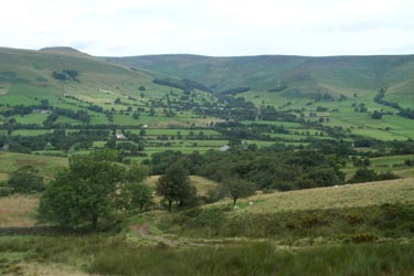
Rushup Edge & Crowden Tower from Edale
Peak District Walk
Nat Park - Peak District - Kinder Scout Edale
County/Area - Derbyshire
Author - Lou Johnson
Length - 10.0 miles / 16.3 km Ascent - 2230 feet / 676 metres
Time - 7 hours 10 minutes Grade - moderate
Maps 

| Ordnance Survey Explorer OL1 | Sheet Map | 1:25k | BUY |
| Anquet OS Explorer OL1 | Digital Map | 1:25k | BUY |
| Ordnance Survey Landranger 110 | Sheet Map | 1:50k | BUY |
| Anquet OS Landranger 110 | Digital Map | 1:50k | BUY |
Walk Route Description
Click image to visit gallery of 9 images.
Edale is one of the finest of the Peak District valleys bounded to the north by Kinder Scout and to the south by the Castleton Ridge and Rushup Edge. This Peak District walk uses the high ground at the head of Edale to enjoy the views and moorland. This walk is also suitable for those without their own transport in which case trains to and from Edale are the best option.
The start is the pay and display car park in Edale (Grid ref 124853). Exit to the south and follow the road west towards Barber Booth. Turn left down the first track passing Hardenclough Farm and Greenalnds. Continue on the waymarked route to reach the road at Mam Nick (Grid ref. 125836). At the col turn right up a clear path that heads west along Rushup Edge. Stay on the north side of the wall to enjoy the best views soon reaching the highest point of Lord's Seat.
Descend gently to reach a path junction (Grid ref. 099829) where you turn north. After approximately 200 metres leave the main path to continue across open moorland to Brown Knoll. In places this path suffers from being wet underfoot but is well defined for most of the way. Reaching Brown Knoll descend northwest to a wall. Turn right along the wall following a clear path to reach the Col above Jacob's Ladder without any further problems.
Continue straight ahead with the head of Edale to your right. The path stays almost level keeping below Edale Rocks as it passes the Noe Stool, Pym Chair, the Woolpacks and Crowden Tower to reach the head of Crowden Clough (Grid ref. 095872). Ignore the path descending into the clough opting to continue ahead across a bluff of moorland to reach the edge above Grindsbrook Clough (Grid ref. 104872). Turn right along the edge path, which leads you to Grindslow Knoll.
From here descend south-east on the path descending to join the Pennine Way for the final stretch into Grindsbrook Booth. Turn right down the lane and within a few minutes you are back at the start.
Other walks nearby
| Walk 2522 | Rushup Edge & Edale from Mam Nick | moderate | 7.0 miles |
| Walk 1368 | Mam Tor, Upper Booth & Rushup Edge | moderate | 7.0 miles |
| Walk 1831 | Mam Tor & Hollins Cross from Mam Nick | easy | 3.0 miles |
| Walk 1688 | Old Dam & Sparrowpit from Mam Nick | moderate | 9.0 miles |
| Walk 1087 | Mam Tor & Cave Dale | moderate | 6.5 miles |
| Walk 1519 | Catleton & Speedwell Cavern Circular | easy | 4.3 miles |
| Walk 1521 | Cave Dale and Winnats Pass | easy | 4.5 miles |
| Walk 1665 | Hollins Cross & Lose Hill | easy/mod | 6.0 miles |
| Walk 3426 | Lose Hill & Hollins Cross | easy/mod | 5.0 miles |
| Walk 1489 | Blackden Brook, Kinder & Upper Ashop | moderate | 6.8 miles |
Recommended Books & eBooks
Walking in Derbyshire
 Walking guidebook to 60 circular day walks in Derbyshire and the Peak District. Includes the Derwent, Wye and Trent river valleys, near Derby, Matlock, Glossop, Bakewell and Ripley. Routes range from easy to moderate and are between 4 and 14km (2 to 10 miles). Walks focus on places of interest, from Stone Age forts to castles to grand estates.
More information
Walking in the Peak District - White Peak East
 Guidebook describing 42 half-day and day walks in the limestone landscapes of Derbyshire's White Peak, part of the Peak District National Park. One of two volumes, this book covers the east of the region, with potential bases including Bakewell, Eyam, Castleton, Birchover, Matlock and Wirksworth.
More information
Messaging & Social Media
Message Walking Britain and follow the latest news.

Mountain Weather
Stay safe on the mountains with detailed weather forecasts - for iOS devices or for Android devices.