Tregaron & Llandewi Brefi circular
Cambrian Mountains Walk
Region - Cambrian Mountains
County/Area - Ceredigion
Author - Dafydd Wyn Morgan
Length - 4.5 miles / 7.3 km Ascent - 650 feet / 197 metres
Time - 2 hours 50 minutes Grade - easy/mod
Walk Route Description
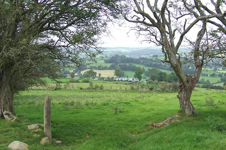
Click image to see photo description.
This linear walk starts from Tregaron and using a mixture of tracks and lanes takes you to the village of Llanddewi Brefi. To return to Tregaron you can use the local bus service which runs on Weekdays and Saturdays or alternatively retrace your steps along the walk.
1 - From the Talbot Hotel, walk down Dewi Road leaving the purple Rhiannon building on your right. Continue to the top of the road turning left, onto a new drive, opposite the Fire Station.
2 - Pass to the right of a cattle grid and over a stile. Keep the field edge to your left for a few paces and then bear right to drop into a dip and then climb steeply to a stile in the fence above - note that there are two stiles quite close together here and you need the left hand, higher one. Walk up the field edge for a 50m to another stile on your right. Cross this and bear diagonally uphill to reach another stile.
3 - Cross this and continue in the same direction to follow the contour of the hilltop to your left before dropping to a stile in a boggy corner, close to a pile of stones. Bear half right to cross the next narrow field to another stile and cross this.
4 - Turn right onto a concrete drive, and continue along to a gate. Shortly after the next telegraph pole, bear left to walk parallel to the edge of a field, up to a gate in the top corner. Go through and cross the farm drive to walk up a stony track to a small gate. Continue along a grassy track to reach a crossing of paths. Here you leave the town trail signs and turn right through a rusty metal gate on a newly designated bridleway (replacing the one south to Pencefn Drysgol).
5 - Cross the grassy field and go through the leftmost of a couple of gates on the far side. Head down a grassy track which becomes increasingly muddy near the farmyard.
6 - Just before the farmyard turn left onto a wide track. Go through a metal gate, and turn right to follow the fence line round and down to the far corner of the field. Continue following this right as it becomes a beech-lined track way. The path narrows as it bends left to descend to a rickety metal gate.
7 - Go through this, then follow the bridleway left (ignoring the sign right to Llanddewi Brefi). This briefly runs parallel to a small stream before fording it and continuing up an often wet tree-lined track. As you near another stream, the track divides. Fork right to ford the stream (poles highly recommended, it can easily be calf-deep and full of greasy pebbles underfoot). Follow the track as it quickly bends uphill before petering out. Now bear right and follow the fence line on the left until the track reappears. Continue on this, very boggy in places, track and cross a third stream to exit through a gate by a barn undergoing renovation to reach the start of tarmac.
8 - Follow this road and eventually it leads moderately steeply down towards the northern end of Llanddewi Brefi. As the descent eases you pass a concrete driveway to Prysg. Just after the next house, turn left over a stile onto a way marked footpath, running along the edge of grassy fields. Cross two further stiles, then the path descends right to briefly run parallel to a small river.
9 - Exit left onto a road into Llanddewi Brefi, where you could take a look around the Church and graveyard, pop into the village shop or grab a quick drink in one of the pubs before catching your bus, or returning via the same route to Tregaron.
Maps 

| Ordnance Survey Explorer 199 | Sheet Map | 1:25k | BUY |
| Anquet OS Explorer 199 | Digital Map | 1:25k | BUY |
| Ordnance Survey Digital Map Subscription | |||
| Latest Ordnance Survey Discounts | |||
Other walks nearby
| Walk 1362 | Tregaron & Cors Caron circular | easy | 4.0 miles |
| Walk 1363 | The Elephant Walk from Tregaron | easy/mod | 5.5 miles |
| Walk 1366 | Pentre Bach circular | easy/mod | 9.5 miles |
| Walk 1365 | Strata Florida to Tregaron | moderate | 9.5 miles |
| Walk 2736 | Teifi Pools from near Strata Florida | easy/mod | 6.2 miles |
| Walk 3086 | Pen y Garn from near Devil's Bridge | easy/mod | 6.8 miles |
| Walk 3674 | Claerwen Valley & Dam from Dolymynach Reservoir | moderate | 7.4 miles |
| Walk 2498 | Gorllwyn circuit, Elan Valley | easy/mod | 6.8 miles |
| Walk 1767 | Allt Wen & Wales Coast Path from Trefechan | easy/mod | 6.0 miles |
| Walk 3297 | Crugyn Ci, Esgair Perfedd & Penygarreg - Elan Valley | moderate | 7.5 miles |
Recommended Books & eBooks
The Wales Coast Path
 A single guidebook to walking the whole Wales Coast Path - 1400km (870 miles) the length of Wales from Chester to Chepstow, including Anglesey, described in 57 stages. The route passes through the Snowdonia and Pembrokeshire National Parks and many AONBs and can be linked with the Offa's Dyke Path for a complete circuit of Wales.
More information
