Cambrian Mountains WalksWalking Routes & Hiking Trails
Find Cambrian Mountains walks from the list below which features the best walking routes in the area. Most are circular walks and are listed from the shortest and easiest to the longest more challenging routes.
The Cambrian Mountains circular walks listed below allow you to explore this wild upland area in Wales. The routes vary from easier walks through to hard hill walks that require careful navigation. All walks are free to download and print, and all longer routes have GPS files. The walks offer views of the coast, traverse the wild scenery, and allow you to explore this area that was once considered as a National Park.
| Walk | Description | Grade | Miles |
|---|---|---|---|
| 1361★ | Tregaron & Twm Town circular | easy | 3.50 |
| 1362 | Tregaron & Cors Caron circular | easy | 4.00 |
| 1364★ | Tregaron & Llandewi Brefi circular | easy/mod | 4.50 |
| 1705★ | Bont-goch Circular from near Aberystwyth | easy/mod | 4.50 |
| 2138★ | Plynlimon Circular from Eisteddfa Gurig | moderate | 5.00 |
| 1304★ | Plynlimon from Esteddfa Gurig | moderate | 5.00 |
| 1363★ | The Elephant Walk from Tregaron | easy/mod | 5.50 |
| 2736★ | Teifi Pools from near Strata Florida | easy/mod | 6.20 |
| 2498★ | Gorllwyn circuit, Elan Valley | easy/mod | 6.75 |
| 3086★ | Pen y Garn from near Devil's Bridge | easy/mod | 6.80 |
| 3297★ | Crugyn Ci, Esgair Perfedd & Penygarreg - Elan Valley | moderate | 7.50 |
| 1365★ | Strata Florida to Tregaron | moderate | 9.50 |
| 1366★ | Pentre Bach circular from near Tregaron | easy/mod | 9.50 |
| 2048★ | Craig-y-Pistyll, Cambrian Mountains | moderate | 10.00 |
| 1102★ | Plynlimon & Nant-y-Moch Reservoir from Esteddfa Gurig | hard | 11.00 |
| 1367★ | Cwm Berwyn from Tregaron | moderate | 11.00 |
★ GPS file ☩ Route profile
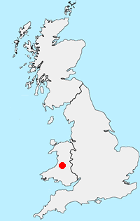
Location Map
Cambrian Mountains Guide
The Cambrian Mountains are a wild and empty plateau lying between the Snowdonia and Brecon Beacons National Parks. They are Wales' fourth national park in-waiting; designated in 1972, the Park was later cheated of recognition and protection, by an unholy alliance of landowners and politicians.
Cambrian-Mountains Walking Guide
Other walks in Britain - For a list of all the areas where walks are available go to the Main Walk Index.
Walk grading - Learn how each walk is assessed and select a walk to suit your ability and experience by going to Walk Grading Details.
Messaging & Social Media
Message Walking Britain and follow the latest news.

Mountain Weather
Stay safe on the mountains with detailed weather forecasts - for iOS devices or for Android devices.