Old Dam & Sparrowpit from Mam Nick
Peak District Walk
Nat Park - Peak District - Great Ridge Castleton
County/Area - Derbyshire
Author - Andy Chaplin
Length - 9.0 miles / 14.6 km Ascent - 1125 feet / 341 metres
Time - 5 hours 40 minutes Grade - moderate
Maps 

| Ordnance Survey Explorer OL1 | Sheet Map | 1:25k | BUY |
| Anquet OS Explorer OL1 | Digital Map | 1:25k | BUY |
| Ordnance Survey Landranger 110 | Sheet Map | 1:50k | BUY |
| Anquet OS Landranger 110 | Digital Map | 1:50k | BUY |
Walk Route Description
Click image to visit gallery of 2 images.
With the obvious attractions of the Edale loop, the countryside to the south is less dramatic but worth a look. This Peak District walk covers the limestone moors and dales to the west of Winnats pass and takes in part of the Limestone Way and Pennine Bridleway.
After parking on the old road below Mam Tor (grid ref. SK129832), take the road south and continue on the path across Windy Knoll. Cross straight over the road (grid ref. SK126826) and take the track up past Rowter Farm. As you pass the farm there are some good views behind you to Mam Tor. Carry on along the track then turn left at the end onto another limestone track. When this meets the Limestone Way at the next gate (grid ref. SK135812), turn right over Old Moor and follow the Limestone Way for 500 metres.
Take the bridleway that goes off on your right through the gate in the wall (grid ref. SK132806). Follow this as it becomes a track and leads past Oxlow Rake to Woodside Farm and Oxlow End. Turn left on the road down to Old Dam Road then right along the road into Old Dam.
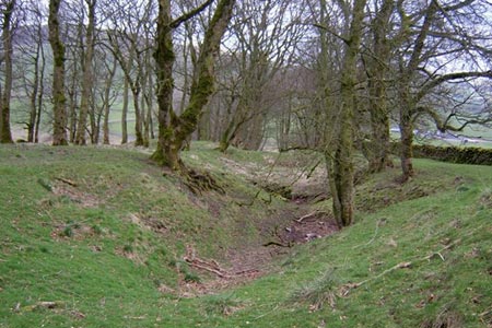
Take the road straight on out of the village which leads up Perry Dale and is part of the Pennine Bridleway. Before you get to Perryfoot turn left up into the wood and take the path that follows an old lead mining rake vein up the hillside below Gautries Hill and the old Coalpit Hole lead mine.
Continue across the fields to Sparrowpit and come out onto the road through the Memorial Hall car park. Turn left towards the Wanted Inn (worth a detour at the end of the walk) then off right through the farmyard, just before the road to Blackbrook, on a path signed to Rushup & Castleton. Pass Rushup Farm and head on across the fields to Rushop Hall.
As you climb up the northern side of the Rushop valley you have good views back into it - an odd little valley bowl surrounded on all sides by the hills that overlook the much more impressive Edale, Hope, and Chapel-en-le-Frith valleys. Turn left on the road in front of Rushop Hall then at the road junction at the top, cross over and take the path that runs alongside the road and leads up to Lords Seat. You now have the views down into the Edale valley.
Continue along towards Mam Tor then cross the "Mam Nick" road and take the path over the field downhill to the parking.
Other walks nearby
| Walk 2522 | Rushup Edge & Edale from Mam Nick | moderate | 7.0 miles |
| Walk 1368 | Mam Tor, Upper Booth & Rushup Edge | moderate | 7.0 miles |
| Walk 1831 | Mam Tor & Hollins Cross from Mam Nick | easy | 3.0 miles |
| Walk 1087 | Mam Tor & Cave Dale | moderate | 6.5 miles |
| Walk 1519 | Catleton & Speedwell Cavern Circular | easy | 4.3 miles |
| Walk 1521 | Cave Dale and Winnats Pass | easy | 4.5 miles |
| Walk 1665 | Hollins Cross & Lose Hill | easy/mod | 6.0 miles |
| Walk 3426 | Lose Hill & Hollins Cross | easy/mod | 5.0 miles |
| Walk 1159 | Grindsbrook & Edale Head | moderate | 7.5 miles |
| Walk 1264 | Rushup Edge & Crowden Tower | moderate | 10.0 miles |
Recommended Books & eBooks
Walking in Derbyshire
 Walking guidebook to 60 circular day walks in Derbyshire and the Peak District. Includes the Derwent, Wye and Trent river valleys, near Derby, Matlock, Glossop, Bakewell and Ripley. Routes range from easy to moderate and are between 4 and 14km (2 to 10 miles). Walks focus on places of interest, from Stone Age forts to castles to grand estates.
More information
Dark Peak Walks
 Guidebook to 40 walks in the Dark Peak area of the Peak District National Park. 35 circular routes for most abilities, from 8km to 19km, around Edale, Marsden, Fairholmes, Baslow and Castleton, including Kinder Scout and Mam Tor, and 5 longer (25km to 45km) routes highlighting the best of the Gritstone Edges, High Moorland and Deep Valleys.
More information
Messaging & Social Media
Message Walking Britain and follow the latest news.

Mountain Weather
Stay safe on the mountains with detailed weather forecasts - for iOS devices or for Android devices.