Shallowford, Hoar Oak Tree & The Chains
Exmoor Walk
Nat Park - Exmoor
County/Area - Devon
Author - Lou Johnson
Length - 11.7 miles / 19 km Ascent - 1350 feet / 409 metres
Time - 7 hours 10 minutes Grade - moderate
Walk Route Description
Click image to see photo description.
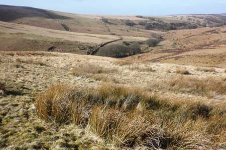
This Exmoor walk explores the wild upland moorland known as the Chains. The route uses sections of three long distance footpaths and offers ever changing views of the landscape. The area can be very wet underfoot and the route is not for inexperienced walkers. In periods when visibility is limited or there is snow on the ground route finding can be difficult so navigational skills are important. With this in mind, an outline route is provided rather than a detailed explanation.
The start is the lay-by (grid ref. SS729401) on the B3358 about three miles west of Simonsbath. Note that there are two lay-bys in this vicinity and the one recommended is the first encountered when arriving from Simonsbath. If you reach the lay-by close to Goats Hill Bridge then you have gone too far. After parking walk east along the road towards Simonsbath. Turn right onto the Macmillan Way West and follow the waymarked route to reach a road by Sloley Stone (grid ref. SS717393). Turn sharp right here onto the Tarka Trail.
Follow the Tarka Trail north over the B3358 to Woodbarrow Gate (grid ref. SS716424) where the Tarka Trail turns east. Leave the Tarka trail and continue north to Saddle Gate and cross Thornworthy Common to reach the road at Shallowford (grid ref. SS713449). Turn right here following the bridleway over the Ilkerton Ridge and down to join the lane at North Furzehill (grid ref. SS725541). Follow the lane north and just after the lane bends left, take the bridleway on the right just after some farm buildings along a track enclosed with hedges.
After 600 metres you reach a junction (grid ref. SS729456). Turn right and continue south over Furzehill Common to Hoaroak and Gammon's Corner. Continue down into the valley near the Hoar Oak Tree (grid ref. SS746430). Do not cross the stream, instead turn right onto the Tarka Trail (and Two Moors Way). The path stays on the western side of the stream in a steep sided valley. After crossing the stream (grid ref. SS746422), the route climbs steadily onto the moorland to reach a junction of paths (grid ref. SS715415).
Turn right (west) to continue along the Tarka Trail and Macmillan Way West. Follow the path for just over 2 kilometres to a path junction (grid ref. SS731418). Turn left here following the Macmillan Way West as it descends gently over the flank of Goat Hill and down to the B3358 and the start of the walk.
Maps 

| Ordnance Survey Explorer OL9 | Sheet Map | 1:25k | BUY |
| Anquet OS Explorer OL9 | Digital Map | 1:25k | BUY |
| Ordnance Survey Digital Map Subscription | |||
| Latest Ordnance Survey Discounts | |||
Other walks nearby
| Walk 3386 | Barle Valley & Cow Castle from Simonsbath | easy/mod | 6.4 miles |
| Walk 3391 | Valley of Rocks frrom Lynton | easy/mod | 3.8 miles |
| Walk 2451 | Withypool & Barle Valley | easy/mod | 6.0 miles |
| Walk 1910 | Countisbury and Watersmeet from Lynmouth | easy/mod | 4.5 miles |
| Walk 3729 | Foreland Point | moderate | 5.0 miles |
| Walk 1263 | The Doone Valley | moderate | 8.5 miles |
| Walk 3390 | Heddon Valley from Woody Bay | moderate | 5.3 miles |
| Walk 1262 | Watersmeet & Foreland Point | mod/hard | 10.5 miles |
| Walk 3394 | Holdstone Down & Trentishoe | moderate | 7.0 miles |
| Walk 2154 | West Anstey Common from Molland | easy/mod | 6.4 miles |
