Exmoor WalksWalking Routes & Hiking Trails
Find Exmoor walks from the list below which features the best walking routes in the area. Most are circular walks and are listed from the shortest and easiest to the longest more challenging routes.
The great Exmoor walks listed below cater for walkers of all abilities from easy low-level and coastal walks to more demanding routes across the moors. All walks are free to download and print and all routes have GPX files. Included in the walks is a walk to the highest point in Exmoor at Dunkery Beacon with outstanding views to be enjoyed from the summit.
| Walk | Description | Grade | Miles |
|---|---|---|---|
| 1750★ | Dunkery Beacon (short ascent) | easy/mod | 2.50 |
| 3391★☩ | Valley of Rocks frrom Lynton | easy/mod | 3.80 |
| 3393★☩ | Great Hangman Hill from Combe Martin | easy/mod | 4.30 |
| 1910★ | Countisbury and Watersmeet from Lynmouth | easy/mod | 4.50 |
| 3729★☩ | Foreland Point from Barna Barrow (Countisbury) | moderate | 5.00 |
| 3390★☩ | Heddon Valley from Woody Bay | moderate | 5.30 |
| 3725★☩ | Selworthy Beacon from Selworthy | easy/mod | 5.50 |
| 2387★ | Pinkery Pond Circular | easy/mod | 5.80 |
| 1222★ | Winsford Hill & the Allotment from Winsford | moderate | 6.00 |
| 2451★ | Withypool & Barle Valley from Landacre Bridge | easy/mod | 6.00 |
| 2154★ | West Anstey Common from Molland | easy/mod | 6.40 |
| 3386★ | Barle Valley & Cow Castle from Simonsbath | easy/mod | 6.40 |
| 3394★☩ | Holdstone Down & Trentishoe | moderate | 7.00 |
| 1860★ | The River Barle and Withypool from Tarr Steps | easy/mod | 7.50 |
| 1220★ | Dunkery Beacon from Wheddon Cross | moderate | 8.00 |
| 1669★ | Anstey Gate & Hawkridge from Tarr Steps | moderate | 8.20 |
| 1263★ | The Doone Valley from Malmsmead | moderate | 8.50 |
| 1221★ | Selworthy Beacon & North Hill from Bossington | moderate | 8.50 |
| 1262★ | Watersmeet & Foreland Point from County Gate | mod/hard | 10.50 |
| 1727★ | Shallowford, Hoar Oak Tree & The Chains | moderate | 11.70 |
★ GPS file ☩ Route profile
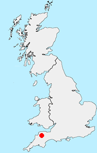
Location Map
Exmoor Guide
Walking in the Exmoor National Park, which lies in West Somerset and North Devon, includes a dramatic section of coast. Wild moorland dominates the high ground with Dunkery Beacon the highest point within the National Park. Wooded valleys or combes cut deep into this upland and provide another typical feature of the landscape. The coast includes some of the highest cliffs in the UK with easy access provided by the South West Coast National Trail.
Exmoor Walking Guide
Other walks in Britain - For a list of all the areas where walks are available go to the Main Walk Index.
Walk grading - Learn how each walk is assessed and select a walk to suit your ability and experience by going to Walk Grading Details.
Messaging & Social Media
Message Walking Britain and follow the latest news.

Mountain Weather
Stay safe on the mountains with detailed weather forecasts - for iOS devices or for Android devices.