Severn Valley from Llanidloes
Powys Walk
County/Area - Powys - Powys North
Author - Lou Johnson
Length - 11.3 miles / 18.4 km Ascent - 1600 feet / 485 metres
Time - 7 hours 20 minutes Grade - moderate
Walk Route Description
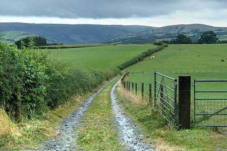
Click image to see photo description.
This Powys walk from Llanidloes explores the hills lying either side of the River Severn. The route heads east from Llanidloes where there are a wide range of amenities and uses the Severn Way to explore the hills above the northern bank of the River Severn. Turning south the walk descends into the valley before gaining the high ground to return to Llanidloes along the Glwndwyr's Way.
The walk starts in Llanidloes town centre at the pay and display car park on the north side of Mount Lane (grid ref. SN955844). Exit the car park at the northern end onto Great Oak Street. Turn left to reach a half-timbered market hall. Turn right onto Long Bridge Street and continue north to a roundabout. Turn left across the River Severn and bear left at the first junction onto the B4518. Walk uphill and just after Tan Yr-Allt on the right, take the signed footpath on the right (grid ref. SN953850) to follow the Severn Way and Glyndwr's Way.
The rising path leads through woodland and then circles left, leaves the woodland, passes beside a golf course, passes to the right of the clubhouse before running along the edge of a small wood on your right. Reaching a track, turn right where Glyndwr's Way goes left, and almost immediately go left along an enclosed bridleway (grids ref. SN955861). After 800 metres you reach the B4569. Go straight across onto a track. Ahead you have some fine views of the Severn Valley. Continue past a barn and continue with hedge right to join a track between hedges. Continue through Cefnmawr farm and follow their access drive to a lane.
Turn left and follow the lane. Reaching a fork, keep right $00 metres beyond the fork at the end of a stand of trees on your right, turn right down a clear track through a metal gate. The route heads south along the left-hand edge of several fields before bearing south-east to reach the access drive for Bont-newydd farm (grid ref. SN982589). Bear left along the track which soon becomes a lane. Continue along the lane for 700 metres to a crossroads. Turn right and follow the quiet road for 1.5 kilometres down to cross the Severn at Dolwen.
Turn right along the A470 using the grass verge. After 200 metres turn left onto a lane. Keep right at a fork and after 500 metres fork left (grid ref. SN997845). Continue along the lane to a bungalow on the left. Leave the lane at this point and follow the grassy track. 250 metres from the lane, the routes veers left to pass a barn at Celyn (on your left). A short way beyond the barn, leave the track and follow the left-hand side of the field. Turn left through the hedge and into a field. Walk half-right up to the top left-hand corner (grid ref. SN905834). A grassy path leads south across the slopes of Moelfre on your left. At the top of the slope, you reach a farm access road (grid ref. SN994829).
Turn left down the farm access road and after 400 metres turn right onto the Glyndwr's Way. After a short distance, the path turns right and then left to cross a track at Blaen-y-cwm. The onwards path is waymarked although an OS 1:25k map is useful. A short climb up through trees leads to a lane at Ashfield (grid ref. SN985825). Continue along the lane to a T-junction with finger post opposite. Turn right and continue to next junction and turn left. Pass a caravan site on the left and continue to where the lane bends right. Take the next path on the left with adjacent fingerpost (grid ref. SN983836).
The path continues through a wood to exit onto lane (grid ref. SN977838). Bear right and follow the lane back towards Llanidloes. Go straight ahead at roundabout and continue as the road bends left. Just after the second bungalow on the right turn right down an enclosed path. Cross the footbridge over the A470 and bear right and then left along a road. At the end of row of terraced houses bear left and reaching a T-junction go right into Great Oak Street. Turn left and just before the Trewythen Hotel turn left back to the car park.
Maps 

| Ordnance Survey Explorer 214 | Sheet Map | 1:25k | BUY |
| Anquet OS Explorer 214 | Digital Map | 1:25k | BUY |
| Ordnance Survey Digital Map Subscription | |||
| Latest Ordnance Survey Discounts | |||
Other walks nearby
| Walk 1102 | Plynlimon & Nant-y-Moch Reservoir | hard | 11.0 miles |
| Walk 1304 | Plynlimon | moderate | 5.0 miles |
| Walk 2138 | Plynlimon Circular | moderate | 5.0 miles |
| Walk 2472 | Abbeycwmhir Circular | easy/mod | 7.2 miles |
| Walk 3696 | Newtown (Y Drenewydd) & Gregynog Circular | mod/hard | 10.3 miles |
| Walk 3705 | Newtown (Y Drenewydd) & Bettws Cedewain Circular | mod/hard | 10.1 miles |
| Walk 3706 | Newtown (Y Drenewydd), Brimmin Wood & Kerry | moderate | 8.3 miles |
| Walk 3707 | Fachwen Pool from Newtown (Y Drenewydd) | easy/mod | 6.0 miles |
| Walk 3708 | Bwlch y ffridd & Fachwen Pool from Newtown | moderate | 9.0 miles |
| Walk 3735 | Newtown (Y Drenewydd) - Waterways & Town | easy | 5.3 miles |
Recommended Books & eBooks
The Cambrian Way
 Guidebook to the Cambrian Way, a challenging three-week mountain trek through Wales from Cardiff to Conwy. The 470km un-waymarked route is presented from south to north. Often sticking to long, beautiful ridgelines, it crosses wild and rugged terrain and visits many of Wales's highest mountains, including Snowdon.
More information
