Newtown (Y Drenewydd) - Waterways & Town
Powys Walk
County/Area - Powys - Powys North
Author - Walking Newtown
Length - 5.3 miles / 8.6 km Ascent - 300 feet / 91 metres
Time - 3 hours 0 minutes Grade - easy
Walk Route Description
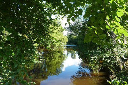
Click image to see photo description.
This Powys walk starts and ends in the centre of Newtown (Y Drenewydd). It leads you out alongside the River Severn and its tributaries and includes some road and off-road walking. The walk returns through woods eventually skirting some industrial and residential areas to reach the town centre. The walk takes you around the western boundaries of Newtown.
1 - This walk starts under the Town Clock at the junction of Broad St, High St and Severn St, the area known locally as 'The Cross'. The building now housing Barclays Bank was erected by Sarah Brisco, a descendent of the Pryce family of Newtown Hall, to commemorate Queen Victoria's Jubilee in 1897. Opposite the clock on Severn Street is the Robert Owen Museum; Robert Owen Memorial Rooms are over the HSBC on the other corner. Robert Owen, the founder of the Co-operative Movement, is one of Newtown's most famous sons.
Walk along Broad St towards Longbridge until you reach the bridge and the old Flannel Exchange on your left. This building is now a cinema and night club. After the Flannel Exchange and before the bridge turn immediately left onto the tarmac footpath. This footpath looks over a lower footpath and the River Severn. Stay on this higher footpath until you reach the footbridge over the river to Dolerw Park, where you switch to the lower path. Continue on this path alongside the river.
2 - Cross a small footbridge over a stream into the grassed area. Leave the path here and walk along the riverbank passing the new skate park and football pitches on your left. Continue following the river on grass, fenced walkways behind housing, informal paths and some tarmac paths. Take the right fork on the tarmac footpath at the Vaynor Park information board (SO 949908). After the path takes you through a second area of housing there are some steps which take you down to the river (Grid ref. SO089909). Follow the river to the left alongside more football pitches. Look out for a path to the right (Grid ref. SO088909) which takes you down to the water's edge and on through woodland until you come to the tributary joining the river. This is the Mochdre Brook and it prevents you from going further along the banks of the Severn.
3 - Follow the footpath to the left at a fingerpost then bear right under the railway and through a pedestrian gate into the field. Follow the hedge on the right until you come to another pedestrian gate. Go through and bear left towards the road. Go through another gate and cross the busy A489 road to Llanidloes and the west. Pick up the footpath to the right of the parking area and follow it with the brook on your right over stiles, gates and small footbridges, alongside a pipeline running above ground for a time until you coming to a well signposted stile leading into a private garden. This is the right of way so go straight, passing a metal shed on your left, on through a gate next to another shed on your right and past the house on your left A field gate then leads you out onto Mochdre Lane (Grid ref. SO088899).
4 - Cross this road, turn right then take the steep side road immediately on your left, crossing under the bypass. A sign warns that there is a weight limit on this road. Go up to the first junction on your left. Take the left turn, up over a hill and then down a dip to another stream on the left.
5 - Ignore the stile on your left before the stream and take the field gate on your left (Grid ref. SO091896) on the other side of the stream. Take the farm track ahead between the fences. After a while the track turns downhill and takes you under the bypass. Take the lower field gate on the right and follow this track uphill until you reach another field gate. Go through this gate, turn left and go through the pedestrian gate on your left onto the road in front of the buildings of Castell y Dail.
6 - From Castell y Dail follow the road down into the start of the industrial estate. Turn right then immediately left on to the main road, Heol Ashley.
7 - Take the first right (Grid ref. SO095901) with Links Electrical Supplies Ltd on your left and Laura Ashley on your right. The road ends at a tarmac footpath. Ignore a turn off to the left and bear right (Grid ref. SO098904) with a large grey industrial building with green trim on the right. Playing fields are to your left.
8 - Go past the school playground on your left and immediately after the playground turn left off the pavement (Grid ref. SO100903), through a wooden gate on to a path that takes you up into the wood. Follow the path through the wood, ignoring the occasional side paths. At the end of the wood, go straight across the field to a gap in the trees ahead.
9 - Go down the steps, over two stiles and onto the road. Turn left and follow this road to the T junction. Turn right on to the bigger road, Plantation Lane. Follow this road until you reach the High School on your left. Take the pedestrian path between the school and the hedge. This turns left to lead you parallel to the A483 Dolfor Road.
10 - Here the path runs alongside a final, surprising bit of running water where the stream from Blackhill and Dolfor is briefly allowed up to see the light of day in a concrete culvert before being submerged again in subterranean pipes. Go under the railway bridge, cross the A489 at the pedestrian crossing. Turn right then immediately left into Park St. Follow this past the library and the Castle Mound in the park on your left to the crossroads at New Church St. Turn left then cross the street, continue left then first right down High St to return to the clock.
A detailed hand-drawn route map showing details of the route - Newtown Waterways & Town Route Map
Maps 

| Ordnance Survey Explorer 215 | Sheet Map | 1:25k | BUY |
| Anquet OS Explorer 215 | Digital Map | 1:25k | BUY |
| Ordnance Survey Digital Map Subscription | |||
| Latest Ordnance Survey Discounts | |||
Other walks nearby
| Walk 3253 | Warren Hill, Gors Lydan & Moelfre Hill | easy/mod | 6.0 miles |
| Walk 1785 | Newcastle on Clun circular | moderate | 7.5 miles |
| Walk 1898 | Severn Valley from Llanidloes | moderate | 11.3 miles |
| Walk 2471 | Clun Valley Circular | easy/mod | 8.1 miles |
| Walk 3266 | The Dingle & Y Golfa from Welshpool | easy/mod | 6.6 miles |
| Walk 2814 | Corndon Hill from Priest Weston | easy | 1.5 miles |
| Walk 2472 | Abbeycwmhir Circular | easy/mod | 7.2 miles |
| Walk 3050 | Clun circular | moderate | 11.5 miles |
| Walk 1809 | Shelve & the Stiperstones from The Bog | moderate | 9.0 miles |
| Walk 2083 | Linley Hill and Linley from The Bog | moderate | 8.5 miles |
Recommended Books & eBooks
The Cambrian Way
 Guidebook to the Cambrian Way, a challenging three-week mountain trek through Wales from Cardiff to Conwy. The 470km un-waymarked route is presented from south to north. Often sticking to long, beautiful ridgelines, it crosses wild and rugged terrain and visits many of Wales's highest mountains, including Snowdon.
More information
