Pewsey Downs from Wootton Rivers
Wiltshire Walk
County/Area - Wiltshire
Author - Lou Johnson
Length - 8.0 miles / 13 km Ascent - 700 feet / 212 metres
Time - 4 hours 40 minutes Grade - easy/mod
Walk Route Description
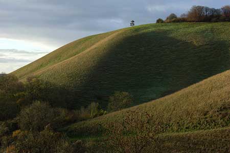
Click image to see photo description.
This Wiltshire walk offers a range of scenery from rolling downs to the open aspect of the Vale of Pewsey. The start is the small car park adjacent to the village hall in the village of Wootton Rivers (grid ref. SU197630). Exit the car park and walk north through the village to join the Mid Wilts Way which leaves the road on your left at grid ref. SU197634. Follow this path north for just under a mile climbing onto the downs. Reaching a path junction at grid ref. SU199642 turn left, following the Mid Wilts Way and continue when the path turns right to meet Mud Lane (grid ref. SU198646).
Turn left along Mud Lane for two miles continuing along the Mid Wilts Way. The way ahead climbs steadily across the rolling downs crossing a lane at grid ref. SU183645. Continue straight ahead with a steep escarpment to your left with an excellent view across the Vale of Pewsey. Reaching a path junction (grid ref. SU176642) continue straight ahead. At a cross-path (grid ref. SU174641) go straight ahead and continue along the southern edge of Withy Copse to reach a cross path (grid ref. SU171641). Turn left here to join the White Horse Trail to continue along a ridge passing Giant's Grave. Continue to descend to a cross path (grid ref. SU161628). Go straight across and continue south to reach Sunnyhill Lane (grid ref. SU161622).
Cross Sunnyhill Lane and take the path opposite remaining on the White Horse Trail to reach Pains Bridge (grid ref. SU164611) on the Kennet and Avon Canal. Turn left along the canal towpath for two and a half miles of easy walking back to Wootton Rivers.
Maps 

| Ordnance Survey Explorer 157 | Sheet Map | 1:25k | BUY |
| Anquet OS Explorer 157 | Digital Map | 1:25k | BUY |
| Ordnance Survey Digital Map Subscription | |||
| Latest Ordnance Survey Discounts | |||
Other walks nearby
| Walk 1733 | Wessex Downs & Kennet & Avon Canal from Pewsey | easy/mod | 8.0 miles |
| Walk 3295 | Pewsey Hill and Fyfield Down | easy/mod | 9.0 miles |
| Walk 1807 | The Southern Escarpment of the Marlborough Downs | easy/mod | 6.5 miles |
| Walk 2339 | Milk Hill the highest point in Wiltshire | easy | 3.0 miles |
| Walk 3517 | Avebury & Overton Down | easy/mod | 7.5 miles |
| Walk 2812 | Avebury, West Kennett and Silbury Hill | easy/mod | 7.0 miles |
| Walk 3417 | Silbury Hill and West Kennett Long Barrow from Avebury | easy | 3.0 miles |
| Walk 3318 | Hackpen Hill & Overton Down | easy/mod | 9.5 miles |
| Walk 2377 | Highlights of Avebury | easy/mod | 8.8 miles |
| Walk 3720 | Ham, Inkpen Hill & Lower Green Circular | easy/mod | 6.0 miles |
Recommended Books & eBooks
The Kennet and Avon Canal
 Guidebook to walking along the Kennet & Avon Canal. The 94 mile route from Reading to Bristol is split into 7 stages of fairly easy walking and includes the UNESCO World Heritage Site of Bath and Bristol's Floating Harbour. 20 circular walks are also included, ranging from 4¼ to 9 miles, taking in the best sections of the canal.
More information
