Wiltshire WalksWalking Routes & Hiking Trails
Find Wiltshire walks from the list below which features the best walking routes in the area. Most are circular walks and are listed from the shortest and easiest to the longest more challenging routes.
The Wiltshire walks listed below range from easy circular walks to longer routes across the downs. All walks are free to download and print and all routes have GPS files. The walks include the glorious countryside and rolling downland allowing you to explore attractive villages, historic houses, and churches.
| Walk | Description | Grade | Miles |
|---|---|---|---|
| 2699★ | Lacock - a village stroll | easy | 1.00 |
| 3417★ | Silbury Hill and West Kennett Long Barrow from Avebury | easy | 3.00 |
| 2339★ | Milk Hill the highest point in Wiltshire | easy | 3.00 |
| 2266★ | Westbury White Horse Circular | easy | 3.60 |
| 2698★ | Castle Combe Circular | easy | 5.00 |
| 3743★ | Win Green from Tollard Royal | easy/mod | 5.40 |
| 2171★ | Knighton Hill & the Ox Drove from Broad Chalke | easy/mod | 5.80 |
| 3720★ | Ham, Inkpen Hill & Lower Green Circular | easy/mod | 6.00 |
| 3632★ | Battlesbury Hill from Norton Bavant | easy/mod | 6.00 |
| 1807★ | The Southern Escarpment of the Marlborough Downs | easy/mod | 6.50 |
| 2158★ | Great Wishford & Grovely Lodge | easy/mod | 6.60 |
| 2812★ | Avebury, West Kennett and Silbury Hill | easy/mod | 7.00 |
| 3517★ | Avebury & Overton Down from Overton Hill | easy/mod | 7.50 |
| 3679★ | Wardour Castle, Ansty Down & Wardour Park | easy/mod | 7.50 |
| 3237★ | Bowerchalke & the Ox Drove from Broad Chalke | easy/mod | 8.00 |
| 1928★ | Pewsey Downs from Wootton Rivers | easy/mod | 8.00 |
| 3347★ | Ford & North Wraxall from Castle Combe | easy/mod | 8.00 |
| 1733★ | Wessex Downs & Kennet & Avon Canal from Pewsey | easy/mod | 8.00 |
| 2343★ | Higher Pertwood & Wessex Ridgeway from Hindon | easy/mod | 8.10 |
| 3727★ | Normanton Down & Stonehenge from Great Durnford | easy/mod | 8.20 |
| 2357★ | Grey Wethers & Fyfield Down from Hackpen White Horse | easy/mod | 8.50 |
| 2255★ | Urchfont Hill from Market Lavington | easy/mod | 8.60 |
| 2936★ | Cold Kitchen Hill from Longbridge Deverill | easy/mod | 8.70 |
| 2377★ | Highlights of Avebury | easy/mod | 8.80 |
| 3295★ | Pewsey Hill and Fyfield Down | easy/mod | 9.00 |
| 3626★ | The Fovant Badges from Broad Chalke | easy/mod | 9.30 |
| 3318★ | Hackpen Hill & Overton Down from Avebury | easy/mod | 9.50 |
| 1748★ | East Knoyle & Hindon from West Knoyle | moderate | 9.60 |
| 2465★ | Steeple Langford Circular | moderate | 9.80 |
Walks that start in adjacent counties / areas.
Walks that start in adjacent counties or areas but cross the boundary and include sections of the route within Wiltshire.
| Walk | Description | Starts In |
|---|---|---|
| 2114★ | Hampshire and Berkshire Heights | Hampshire |
| 1419★ | The Lambourn Downs from near Astbury | Oxfordshire |
★ GPS file ☩ Route profile
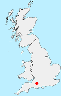
Location Map
Wiltshire Guide
Wiltshire is a rural county characterised by its high chalk downland and wide valleys. Salisbury Plain is noted for being the location of the Stonehenge and Avebury stone circles and other ancient landmarks, and as a training area for the British Army. The highest point in the county is the Tan Hill-Milk Hill ridge in the Pewsey Vale, just to the north of Salisbury Plain, at 295 m (968 ft) above sea level. The Marlborough Downs are part of the North Wessex Downs National Landscape (formerly AONB). In the southeast of the county there is a small section of the New Forest.
Other walks in Britain - For a list of all the areas where walks are available go to the Main Walk Index.
Walk grading - Learn how each walk is assessed and select a walk to suit your ability and experience by going to Walk Grading Details.
Messaging & Social Media
Message Walking Britain and follow the latest news.

Mountain Weather
Stay safe on the mountains with detailed weather forecasts - for iOS devices or for Android devices.