Piddington & Horsleys Green Circular
Chilterns Walk
Region - Chilterns
County/Area - Buckinghamshire - South Buckinghamshire
Author - Lou Johnson
Length - 4.9 miles / 8 km Ascent - 400 feet / 121 metres
Time - 2 hours 50 minutes Grade - easy
Walk Route Description
Click image to see photo description.
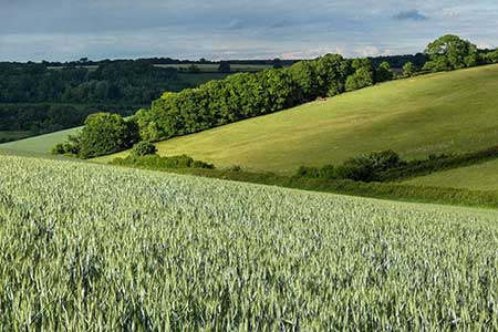
This Chilterns walk explores an area of woodland and farmland to the west of Piddington. The route follows bridleways and footpaths with a short section along a road. The walk passes through Bottom Wood to reach Ashridge Farm. The undulating route continues south across fields to Horsleys Green and on through Dell's Wood before a final section across farmland back to the start.
The start is a small layby just east of the Dashwood Roadhouse off the A40 (grid ref. SU808943). After parking walk to the A40 and cross with care to the access drive to Ham Farm and follow the signed bridleway past the farm on your right. Continue ahead along a track ignoring paths to right and left. The bridleway soon enters woodland where you keep ahead for just under two kilometres to exit Bottom Wood (grid ref. SU791956).
Turn right by an information board, pass through a gate, and continue along the left-hand side of several fields to a lane (grid ref. SU788960). Ignore the path signed on the left and cross the lane and pass between metal barriers. Continue for 300 metres along the enclosed path through a second set of barriers. Turn left onto a path and continue across fields to reach Bricks Lane (grid ref. SU784956). Cross the lane and take the footpath opposite and slightly to the right. The onward path follows arrows on trees to enter a field. Once in the field bear half-left and continue uphill to a gate that leads onto the A40.
Cross the A40 (with care) to a wooden gate opposite. Continue through the woodland for 350 metres to a path junction (grid ref. SU780952). Turn left to exit the wood through a gate into a field. Path heads half-left across the field to another gate and follow path which leads to a road. Turn right and after 120 metres turn left into Audley Wycliffe Park. Keep ahead for 150 metres and take the path on the right just past a post box (grid ref. SU786949). Continue along the path into Dell's Wood to reach a junction of paths (grid ref. SU786945). Fork left onto a bridleway which descends steeply at first.
Exit Dell's Wood and continue ahead along the bridleway keeping to the right-hand side of the field. Towards the end of the second field the route follows a clearer track which soon bends right. After 200 metres you reach a cross track. Turn left and follow the clear track for 800 metres to a road. Turn left and then first right to return to the start.
Maps 

| Ordnance Survey Explorer 172 | Sheet Map | 1:25k | BUY |
| Anquet OS Explorer 172 | Digital Map | 1:25k | BUY |
| Ordnance Survey Digital Map Subscription | |||
| Latest Ordnance Survey Discounts | |||
Other walks nearby
| Walk 2470 | West Wycombe & Bledlow Ridge | moderate | 8.2 miles |
| Walk 1617 | Saunderton circular via Bledlow Ridge | moderate | 11.3 miles |
| Walk 1333 | The Ridgeway around Chinnor | easy/mod | 9.0 miles |
| Walk 2398 | Turville Circular | easy | 4.1 miles |
| Walk 1966 | Turville & Hambleden circular | moderate | 9.6 miles |
| Walk 3520 | Princes Risborough circular | easy/mod | 9.5 miles |
| Walk 1954 | Fingest & Turville from Hambleden | moderate | 11.4 miles |
| Walk 3359 | Christmas Common, Ibstone Common & Turville Heath | easy/mod | 8.5 miles |
| Walk 1140 | The Ridgeway around Lewknor | moderate | 13.0 miles |
| Walk 2324 | Christmas Common Circular | easy | 4.8 miles |
