Turville Circular
Pub Walk + Hill Walk + Woodland Walk
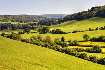
Chilterns Walk
Region - Chilterns
County/Area - Buckinghamshire - South Buckinghamshire
Author - Lou Johnson
Length - 4.1 miles / 6.7 km Ascent - 620 feet / 188 metres
Time - 2 hours 40 minutes Grade - easy
Walk Route Description
Click image to see photo description.
Circular walk exploring the Chiltern landscape north of the village of Turrville towards Cadmore End. The undulating route crosses open countryside and passes through woodland. The walk starts from the centre of Turville village (grid ref. SU768911) where parking is normally available near the village green.
Cross the green to a track between houses with an adjacent fingerpost. After a short distance turn right along the Chiltern Way. The route crosses a field and then runs along the edge of a small wood to reach Oxford Road. Go straight across into trees and fork right to follow the path into Fingest (grid ref. SU777911). Just past the church on your left, turn left along Chequers Lane. After 100 metres turn right along a signed enclosed footpath. After 100 metres fork right and continue along the right-hand edge of two fields to reach a track (grid ref. SU780914). Continue ahead for 300 metres and then fork left uphill following a waymarked bridleway. The route climbs gently for just over a kilometre through woodland.
Approaching Cadmore End you the track passes between hedges to reach a clear track by a small wood (grid ref. SU781925). Turn left and follow the path uphill. The path soon starts to descend and soon forks left into woodland as indicated by a waymark. Continue along the bridleway to reach Chequers Lane (grid ref. SU772924). Cross the lane to the stile opposite and head across the field to a stile. Cross the stile and turn left downhill along a clear track. The track leads to a green lane. Turn left and follow the green lane for just under a kilometre towards a lane at Gravesend (grid ref. SU774918).
Just before the lane, turn sharp right with yellow waymark. After 50 metres fork left and continue uphill through woodland to Oxford Road (grid ref. SU770915). Turn right past Cobstone Windmill and then left through a metal kissing gate. Follow the path steeply downhill back to Turville.
Maps 

| Ordnance Survey Explorer 171 | Sheet Map | 1:25k | BUY |
| Anquet OS Explorer 171 | Digital Map | 1:25k | BUY |
| Ordnance Survey Digital Map Subscription | |||
| Latest Ordnance Survey Discounts | |||
Other walks nearby
| Walk 1966 | Turville & Hambleden circular | moderate | 9.6 miles |
| Walk 1965 | Piddington & Horsleys Green Circular | easy | 4.9 miles |
| Walk 3359 | Christmas Common, Ibstone Common & Turville Heath | easy/mod | 8.5 miles |
| Walk 1954 | Fingest & Turville from Hambleden | moderate | 11.4 miles |
| Walk 2324 | Christmas Common Circular | easy | 4.8 miles |
| Walk 2140 | Christmas Common & Greenfield circular | easy/mod | 7.8 miles |
| Walk 1335 | The Ridgeway at the End of the Chilterns from Watlington Hill | easy/mod | 10.0 miles |
| Walk 2470 | West Wycombe & Bledlow Ridge | moderate | 8.2 miles |
| Walk 1333 | The Ridgeway around Chinnor | easy/mod | 9.0 miles |
| Walk 1617 | Saunderton circular via Bledlow Ridge | moderate | 11.3 miles |
