Christmas Common Circular
Chilterns Walk
Region - Chilterns
County/Area - Oxfordshire & Buckinghamshire
Author - Lou Johnson
Length - 4.8 miles / 7.8 km Ascent - 500 feet / 152 metres
Time - 2 hours 50 minutes Grade - easy
Walk Route Description
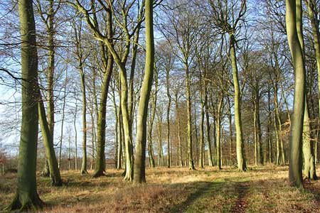
Click image to see photo description.
This is a pleasant walk in the Chilterns exploring typical scenery of the area. The route includes woodland, open farmland and pretty villages using sections of two long distance footpaths - the Oxfordshire Way and the Chiltern Way. The walk follows well-trodden paths although care is needed with navigation and an OS 1:25000 map will prove useful.
The start is the parking area on the western slopes of Watlington Hill just to the west of the centre of Christmas Common on Hill Road at grid ref. SU710935. Exit the car park and turn right towards the centre of Christmas Common. At the first road junction turn right and continue for under 200 metres to join a footpath on your left (grid ref. SU714932). Follow this path as it turns right and then left to enter woodland and meet a track (grid ref. SU716934). Turn right following the signs for PY3 and follow the path into woodland. Previous walkers have made a short cut which bears right off the official right of way to meet a cross path on the southern edge of Shotridge Wood (grid ref. SU718935). Turn right and almost immediately bear left onto a descending path (signed SH4) through Shotridge Wood. Follow this path for just over a mile through woods to reach a junction with the Chiltern Way (grid ref. SU735934).
Turn sharp right and follow the Chiltern Way as it enters further woodland to reach a road at Northend (grid ref. SU730927). Cross the road and continue following the waymarked Chiltern Way across fields before entering Fire Wood. Approximately 300 metres after entering the wood the Chiltern Way meets the Oxfordshire Way (grid ref. SU727918). Turn right here and follow the Oxfordshire Way as it passes through Fire Wood to reach a quiet tarmac road (grid ref. SU717928). Bear right along the road and almost immediately take the continuation of the Oxfordshire Way on your left. This leads through the northern part of Queen Wood to a road (grid ref. SU714930). Turn right along this road and continue past the first junction. At the next junction, turn left and the start of the walk is a short distance along Hill Road on your left.
Maps 

| Ordnance Survey Explorer 171 | Sheet Map | 1:25k | BUY |
| Anquet OS Explorer 171 | Digital Map | 1:25k | BUY |
| Ordnance Survey Digital Map Subscription | |||
| Latest Ordnance Survey Discounts | |||
Other walks nearby
| Walk 1335 | The Ridgeway at the End of the Chilterns from Watlington Hill | easy/mod | 10.0 miles |
| Walk 3359 | Christmas Common, Ibstone Common & Turville Heath | easy/mod | 8.5 miles |
| Walk 1140 | The Ridgeway around Lewknor | moderate | 13.0 miles |
| Walk 2398 | Turville Circular | easy | 4.1 miles |
| Walk 1333 | The Ridgeway around Chinnor | easy/mod | 9.0 miles |
| Walk 1965 | Piddington & Horsleys Green Circular | easy | 4.9 miles |
| Walk 1966 | Turville & Hambleden circular | moderate | 9.6 miles |
| Walk 1954 | Fingest & Turville from Hambleden | moderate | 11.4 miles |
| Walk 1617 | Saunderton circular via Bledlow Ridge | moderate | 11.3 miles |
| Walk 2470 | West Wycombe & Bledlow Ridge | moderate | 8.2 miles |
