Knighton Hill & the Ox Drove from Broad Chalke
Wiltshire Walk
County/Area - Wiltshire
Author - Lou Johnson
Length - 5.8 miles / 9.4 km Ascent - 620 feet / 188 metres
Time - 3 hours 30 minutes Grade - easy/mod
Walk Route Description
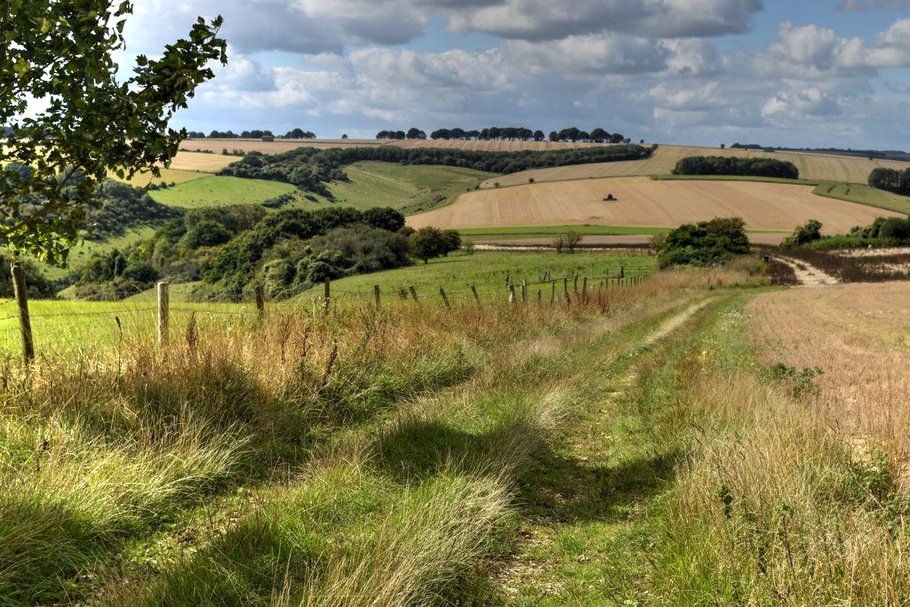
Click image to see photo description.
A Wiltshire walk from Broad Chalke exploring the beautiful downs to the southeast of the village. The undulating route uses paths and tracks to climb onto Knighton Hill which as the highest point of the walk offers an excellent view north across the Ebble Valley. The walk continues across the downs following tracks to pass through the Middleton Down Nature Reserve back to the start.
Limited on street parking is available on South Street near the parish church (grid ref. SU040253). After parking walk east along South Street passing the church on your left. At the next junction turn right and follow the lane up to a crossroad (grid ref. SU042252) where you take the track opposite (signed as a bridleway). After 100 metre along the track turn left at the waymark into a large field. Bear half right along a grassy track and continue into the next field (grid ref. SU048248). Bear right and if the field is cropped keep to the left-hand side of the field and follow the hedge into the field corner where you turn left for 200 metres to join a path on the right (grid ref. SU053242). Reaching a wide grassy track, turn left and pass Knighton Hill Farm on your left.
Maintain direction past the farm joining a clear farm track. Where this track bends left, continue ahead to walk down Bishopstone Hollow (track) which soon becomes enclosed by hedges. Reaching a T-junction of tracks, with a barn on your left, turn right onto a track (Croucheston Drove). Follow this as it twists uphill for 1.4 kilometres to a fingerpost (grid ref. SU067232). Turn right along a track between hedges. After 800 metres you reach a well-defined cross track (grid ref. SU060232). Turn right and almost immediately left along the Ox Drove. After 800 metres (grid ref. SU052229) turn right downhill on a track passing through the Middleton Down Nature Reserve. The track briefly passes through woodland before continuing downhill into Broad Chalke.
Maps 

| Ordnance Survey Explorer 130 | Sheet Map | 1:25k | BUY |
| Anquet OS Explorer 130 | Digital Map | 1:25k | BUY |
| Ordnance Survey Digital Map Subscription | |||
| Latest Ordnance Survey Discounts | |||
Other walks nearby
| Walk 3626 | The Fovant Badges from Broad Chalke | easy/mod | 9.3 miles |
| Walk 2448 | Ackling Dyke from Sixpenny Handley | easy/mod | 8.6 miles |
| Walk 3679 | Wardour Castle, Ansty Down & Wardour Park | easy/mod | 7.5 miles |
| Walk 3743 | Win Green from Tollard Royal | easy/mod | 5.4 miles |
| Walk 2158 | Great Wishford & Grovely Lodge | easy/mod | 6.6 miles |
| Walk 2465 | Steeple Langford Circular | moderate | 9.8 miles |
| Walk 2343 | Higher Pertwood & Wessex Ridgeway from Hindon | easy/mod | 8.1 miles |
| Walk 3727 | Normanton Down & Stonehenge from Great Durnford | easy/mod | 8.2 miles |
| Walk 2666 | North west of the New Forest circular | easy/mod | 9.3 miles |
| Walk 3544 | Frogham and the Hampton Ridge | easy | 3.9 miles |
Recommended Books & eBooks
The Kennet and Avon Canal
 Guidebook to walking along the Kennet & Avon Canal. The 94 mile route from Reading to Bristol is split into 7 stages of fairly easy walking and includes the UNESCO World Heritage Site of Bath and Bristol's Floating Harbour. 20 circular walks are also included, ranging from 4¼ to 9 miles, taking in the best sections of the canal.
More information
