Normanton Down & Stonehenge from Great Durnford
Wiltshire Walk
County/Area - Wiltshire
Author - Lou Johnson
Length - 8.2 miles / 13.3 km Ascent - 550 feet / 167 metres
Time - 4 hours 40 minutes Grade - easy/mod
Walk Route Description
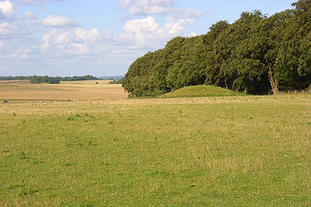
Click image to see photo description.
This Wiltshire circular walk from Great Durnford provides excellent walking and as a bonus you can enjoy a wonderful view of Stonehenge. The route follows green lanes and tracks across the downs passing the remains of burial mounds and other ancient earthworks along the way. The views are excellent including the Avon Valley during the descent back to Great Durnford.
The start is the Black Horse pub in Great Durnford (grid ref. SU135380) where patrons can use their car park. Limited parking on the road nearby is also possible. Exit the car park and turn right. After 100 metres turn right along a track with adjacent finger post. Cross the River Avon to a track. Turn right and keep straight ahead. The track rises to a road (grid ref. SU132386). Cross the road and take the stile opposite signed to Normanton Down. The path skirts woodland to your left. After 400 metres the path turns right and drops down to a lane (grid ref. SU129389). Turn left and follow the track up the valley for 1.5 kilometres to reach Springbottom Farm.
150 metres beyond the stables keep ahead (slightly right) where the track forks. Follow the grassy track for a further 1.5 kilometres onto Normanton Down to reach a National Trust sign (grid ref SU120413) where you turn left through a kissing gate. By walking ahead on the track, you can enjoy a grandstand view of Stonehenge on the other side of the A303. Return to the kissing gate and cross an area rich in tumuli. After 300 metres go left through the next kissing gate (grid ref. SU117415). Follow the clear track southwest for 2.5 kilometres over Wilsford Down to the A360. Again, this section of the walk is rich in ancient earthworks.
Turn left along the A360 for about 250 metres to reach a fingerpost (Upper Woodford) on the left (grid ref. SU100389). Follow the path for three kilometres descending into the Avon Valley and a road at Upper Woodford (grid ref. SU124373). Turn left and after 60 metres turn right at a fingerpost to join a track. Continue along this track for a kilometre to re-join the outward route. Turn right across the River Avon and continue to a road. Turn left back to the start.
Maps 

| Ordnance Survey Explorer 130 | Sheet Map | 1:25k | BUY |
| Anquet OS Explorer 130 | Digital Map | 1:25k | BUY |
| Ordnance Survey Digital Map Subscription | |||
| Latest Ordnance Survey Discounts | |||
Other walks nearby
| Walk 2158 | Great Wishford & Grovely Lodge | easy/mod | 6.6 miles |
| Walk 2465 | Steeple Langford Circular | moderate | 9.8 miles |
| Walk 3626 | The Fovant Badges from Broad Chalke | easy/mod | 9.3 miles |
| Walk 3237 | Bowerchalke & the Ox Drove | easy/mod | 8.0 miles |
| Walk 2171 | Knighton Hill & the Ox Drove | easy/mod | 5.8 miles |
| Walk 2255 | Urchfont Hill from Market Lavington | easy/mod | 8.6 miles |
| Walk 3295 | Pewsey Hill and Fyfield Down | easy/mod | 9.0 miles |
| Walk 3679 | Wardour Castle, Ansty Down & Wardour Park | easy/mod | 7.5 miles |
| Walk 2343 | Higher Pertwood & Wessex Ridgeway from Hindon | easy/mod | 8.1 miles |
| Walk 1733 | Wessex Downs & Kennet & Avon Canal from Pewsey | easy/mod | 8.0 miles |
Recommended Books & eBooks
The Kennet and Avon Canal
 Guidebook to walking along the Kennet & Avon Canal. The 94 mile route from Reading to Bristol is split into 7 stages of fairly easy walking and includes the UNESCO World Heritage Site of Bath and Bristol's Floating Harbour. 20 circular walks are also included, ranging from 4¼ to 9 miles, taking in the best sections of the canal.
More information
