Rushup Edge & Mam Tor from Edale
Peak District Walk
Nat Park - Peak District - Kinder Scout Edale
County/Area - Derbyshire
Author - Lou Johnson
Length - 10.0 miles / 16.3 km Ascent - 1700 feet / 515 metres
Time - 6 hours 40 minutes Grade - moderate
Walk Route Description
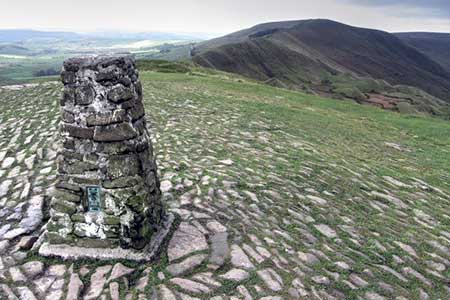
Click image to see photo description.
Edale is surrounded by a ring of hills and gritstone edges which provide a variety of excellent walks. This route starts from the village of Edale, and after using a section of the Pennine Way to the top of Jacob's Ladder turns south across moorland to Brown Knoll. The walk continues to Rushup Edge where the ridge is followed to Mam Nick. A short ascent leads to the summit of Mam Tor. A section along the Castleton Great Ridge to Hollins Cross and a descent back to the start.
The start is the large car park or railway station at Edale served by trains between Manchester and Sheffield (grid ref. SK124853). On arrival continue uphill into the village past the church to the Old Nags Head where you turn left onto the Pennine Way to Upper Booth. From here stay on the Pennine Way and ascend Jacob's Ladder on the southern slopes of Kinder Scout to reach the point where the Pennine Way turns sharp right (grid ref. SK081861).
After passing through a gate, turn left on a paved path to cross Brown Knoll. After 800 metres locate another paved path heading left. Take this and continue to the trig point of Brown Knoll. The onward route heads southeast across the moor for just over two kilometres to reach a track (grid ref. SK099832). Turn right and continue to a wall. Turn left, signed to Mam Tor and Hollins Cross, and continue over the ridge of Rushup Edge and the summit at Lord's Seat. From here a clear path leads down to the road at Mam Nick. Turn left and shortly after right onto the path which climbs steeply onto Mam Nick. Take time to enjoy the view which includes most this walk.
Descend from Mam Tor along the Castleton Great Ridge and continue to a col at Hollins Cross (grid ref. SK136845) which offers a final chance to enjoy the view north to Kinder and south into the White Peak. Leave the ridge path and turn sharp left and continue for a short way to a junction where you keep left along a signed bridleway which leads towards Greenlands. Reaching a junction just before Greenlands, turn right and follow the farm access lane downhill to the valley road. Turn right and then first left to return to Edale station or car park.
At the three-way fingerpost turn right downhill to the Plough at Casden (grid ref. SP826045). Turn left along the road and the right through a gap in a fence with waymarks attached. Follow the Ridgeway through Pulpit Hill Nature Reserve. Go straight ahead at a cross path and continue across a field to reach the outward route as noted in paragraph two. Turn left and walk downhill to the start at Great Kimble.
Maps 

| Ordnance Survey Explorer OL1 | Sheet Map | 1:25k | BUY |
| Anquet OS Explorer OL1 | Digital Map | 1:25k | BUY |
| Ordnance Survey Digital Map Subscription | |||
| Latest Ordnance Survey Discounts | |||
Other walks nearby
| Walk 2522 | Rushup Edge & Edale from Mam Nick | moderate | 7.0 miles |
| Walk 1368 | Mam Tor, Upper Booth & Rushup Edge | moderate | 7.0 miles |
| Walk 1831 | Mam Tor & Hollins Cross from Mam Nick | easy | 3.0 miles |
| Walk 1688 | Old Dam & Sparrowpit from Mam Nick | moderate | 9.0 miles |
| Walk 1087 | Mam Tor & Cave Dale | moderate | 6.5 miles |
| Walk 1519 | Catleton & Speedwell Cavern Circular | easy | 4.3 miles |
| Walk 1521 | Cave Dale and Winnats Pass | easy | 4.5 miles |
| Walk 1665 | Hollins Cross & Lose Hill | easy/mod | 6.0 miles |
| Walk 3426 | Lose Hill & Hollins Cross | easy/mod | 5.0 miles |
| Walk 1489 | Blackden Brook, Kinder & Upper Ashop | moderate | 6.8 miles |
Recommended Books & eBooks
The Pennine Way
 Guidebook to the Pennine Way National Trail with OS map booklet. The 265 mile route from Edale to Kirk Yetholm takes three weeks to walk and is suitable for fit and experienced long distance walkers. The route crosses the Peak District, Yorkshire Dales and North Pennines National Parks. Includes separate OS 1:25,000 map booklet of the route.
More information
Pennine Way Map Booklet
 Map of the 270 miles (435km) Pennine Way National Trail, between Edale in the Peak District and Kirk Yetholm in the Scottish Borders. This booklet is included with the Cicerone guidebook to the trail, and shows the full route on Ordnance Survey 1:25,000 maps. This popular long-distance route typically takes three weeks to complete.
More information
