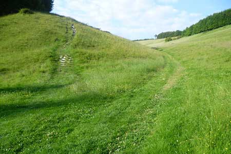
Arundel Park and the River Arun
South Downs Walk
Nat Park - South Downs
County/Area - West Sussex
Author - Lou Johnson
Length - 7.2 miles / 11.7 km Ascent - 600 feet / 182 metres
Time - 4 hours 10 minutes Grade - easy/mod
Maps 

| Ordnance Survey Explorer OL10 | Sheet Map | 1:25k | BUY |
| Anquet OS Explorer OL10 | Digital Map | 1:25k | BUY |
| Ordnance Survey Landranger 198 | Sheet Map | 1:50k | BUY |
| Anquet OS Landranger 198 | Digital Map | 1:50k | BUY |
Walk Route Description
Click image to see photo description.
This walk allows you to explore the castle, cathedral and lovely High Street of Arundel before venturing into the surrounding countryside to enjoy Arundel Park and the River Arun. The start is the car park beside the river (grid ref. TQ020071) which is easily reached from the A27 bypass.
After parking, walk into the centre turning right into High Street. Continue up High Street with the Castle to your right. Continue into London Road passing the Cathedral on your left. The route leaves London Road at grid ref. TQ013073 where you branch to your right to follow the Monarch's Way into Arundel Park. The route crosses Arundel Park and you should stay on the Monarch's Way which is generally well signed. You pass Hiorne Tower to your left.
The path through the Park is undulating and leads you north to eventually enter South Wood (grid ref. TQ012098). Continue following the Monarch's Way down through the wood to reach a junction of paths beside the River Arun (grid ref. TQ014103). Here leave the Monarch's Way and follow the path south with the River Arun to your left and continue to South Stoke.
Reaching the lane through South Stoke, turn left and continue to the bridge over the river. Do not cross the river, instead dropping down to follow the clear path along the river bank. All that remains is to continue along the river for about 3 miles until you reach the start of the walk on the outskirts of Arundel.
Other walks nearby
| Walk 2835 | Arundel to Amberley | easy | 6.2 miles |
| Walk 1423 | Midhurst Way - Arundel to Midhurst | mod/hard | 19.0 miles |
| Walk 3305 | Amberley Mount and Wepham Down | easy/mod | 8.0 miles |
| Walk 1917 | Rackham Hill from Amberley | easy/mod | 6.5 miles |
| Walk 1615 | Amberley & East Dean Circular | mod/hard | 21.0 miles |
| Walk 1466 | Amberley and Arundel Circular | moderate | 13.0 miles |
| Walk 1628 | Bignor Hill and The Denture from Amberley | moderate | 8.7 miles |
| Walk 1629 | The River Arun & South Stoke | easy | 4.6 miles |
| Walk 2487 | Littlehampton to Climping | easy | 5.0 miles |
| Walk 1667 | Blackpatch Hill & Harrow Hill from near Storrington | easy/mod | 7.2 miles |
Recommended Books & eBooks
Walks in the South Downs National Park
 Guidebook with 40 circular walks throughout the South Downs National Park, exploring the beautiful chalk hills between Eastbourne and Winchester. The walks range from under 5 miles to 11 miles, including Beachy Head and the Seven Sisters, Ditchling Beacon and hundreds of prehistoric sites. Accessible all year, but wild flowers best in spring.
More information
Messaging & Social Media
Message Walking Britain and follow the latest news.

Mountain Weather
Stay safe on the mountains with detailed weather forecasts - for iOS devices or for Android devices.