Forest of Bowland WalksWalking Routes & Hiking Trails
Find Forest of Bowland walks from the list below which features the best walking routes in the area. Most are circular walks and are listed from the shortest and easiest to the longest more challenging routes.
Listed below are the best places to walk in the Forest of Bowland. The hikes range from easy circular walks to longer more demanding routes. Located in northern Lancashire, the Forest of Bowland includes wild upland and cultivated valleys. The area is part of the main Pennine range, dominated by gritstone fells with summits above 450 m and large areas of heather-covered peat moorland. Pendle Hill, a large isolated hill, is located in the south eastern edge of the area. The walks cover the highlights of this area including Pendle Hill, Whin Fell and Dunsop Fell as well the valleys and moors of this beautiful part of England. All walks are free to download and print, and all routes have GPX files.
| Walk | Description | Grade | Miles |
|---|---|---|---|
| 2216 | Slaidburn Village Trail - Ribble Valley | easy | 0.75 |
| 3459★ | Abbeystead Reservoir Circular from Stoops Bridge | easy | 1.60 |
| 2164★ | Clougha Pike from the Jubilee Tower | easy/mod | 4.70 |
| 2257★ | Clougha Pike from Quernmore | easy/mod | 4.80 |
| 1267★ | Pendle Hill from Barley Green | moderate | 5.00 |
| 2720★ | Pendle Hill (use in mist) from Barley Green | moderate | 5.00 |
| 2137★ | Clougha & Goldsworthy's Installation Circular | moderate | 5.20 |
| 2293★ | Weets Hill from Barnoldswick | easy/mod | 5.30 |
| 2505★ | Fair Snape Fell from Fell Foot, Forest of Bowland | moderate | 6.00 |
| 1655★ | Downham & Pendle Hill (short version) | moderate | 6.30 |
| 2938★ | Nick of Pendle from Pendleton | easy/mod | 6.30 |
| 3457★ | Wyre Valley Circular from Abbeystead | easy/mod | 6.40 |
| 2256★ | Great Stone of Fourstones from High Bantham | easy/mod | 6.70 |
| 2384★ | Hodder Valley from Whitewell | easy/mod | 6.80 |
| 2452★ | Dunsop Head from Slaidburn | easy/mod | 7.00 |
| 3730★ | Stocks Reservoir Circular | easy/mod | 7.00 |
| 2437★ | Bowland Knotts from Cross of Greet Bridge | moderate | 7.40 |
| 3111★ | Barley Circular from Barrowford | easy/mod | 7.50 |
| 1742★ | Grit Fell from the Jubilee Tower near Quernmore | moderate | 7.70 |
| 2555★ | Whitendale from Dunsop Bridge | moderate | 8.00 |
| 1902★ | Saddle Fell, Fair Snape Fell & Parlick from Chipping | moderate | 8.00 |
| 1818★ | Downham & Pendle Hill | moderate | 8.00 |
| 2331★ | Whin Fell & Ouster Rake from Dunsop Bridge | moderate | 8.30 |
| 1287★ | Circuit of Pendle Hill from Barley Green | moderate | 8.50 |
| 3505★ | Whitewell via Crag Stones from Dunsop Bridge | easy/mod | 8.50 |
| 3038★ | Wolfhole Crag from Tower Lodge | moderate | 9.00 |
| 1218★ | Fiensdale Head & Bleasdale Water from near Sykes Farm | moderate | 10.00 |
| 2510★ | Totridge Fell via Langden & Bleadale Water | mod/hard | 10.00 |
| 2508★ | Dunsop Fell & the Forest of Bowland | moderate | 10.00 |
| 2594★ | Totridge Fell & Fiendsdale Head, Forest of Bowland | moderate | 11.00 |
| 1670★ | Hazelhurst Fell, Fair Snape Fell and Parlick from Delph Lane | moderate | 11.00 |
| 3329★ | Stocks Reservoir from Slaidburn | moderate | 11.50 |
| 2278★ | Ward's Stone from Stoops Bridge | mod/hard | 13.00 |
| 2556★ | Whitendale & Dunsop Fell from Dunsop Bridge | mod/hard | 15.00 |
★ GPS file ☩ Route profile
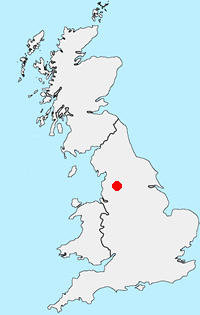
Location Map
Forest of Bowland Guide
The Forest of Bowland walks cater for walkers of all abilities from easy low-level walks to walks across the hills and moors. All walks are free to download and print and all routes have GPS files. The walks cover the highlights of this area including Pendle Hill, Whin Fell and Dunsop Fell as well the valleys and moors of this beautiful part of England.
Forest-of-Bowland Walking Guide
Other walks in Britain - For a list of all the areas where walks are available go to the Main Walk Index.
Walk grading - Learn how each walk is assessed and select a walk to suit your ability and experience by going to Walk Grading Details.
Messaging & Social Media
Message Walking Britain and follow the latest news.

Mountain Weather
Stay safe on the mountains with detailed weather forecasts - for iOS devices or for Android devices.