Catleton & Speedwell Cavern Circular
Peak District Walk
Nat Park - Peak District - Great Ridge Castleton
County/Area - Derbyshire
Author - Lou Johnson
Length - 4.3 miles / 6.9 km Ascent - 650 feet / 197 metres
Time - 2 hours 50 minutes Grade - easy
Maps 

| Ordnance Survey Explorer OL1 | Sheet Map | 1:25k | BUY |
| Anquet OS Explorer OL1 | Digital Map | 1:25k | BUY |
| Ordnance Survey Landranger 110 | Sheet Map | 1:50k | BUY |
| Anquet OS Landranger 110 | Digital Map | 1:50k | BUY |
Walk Route Description
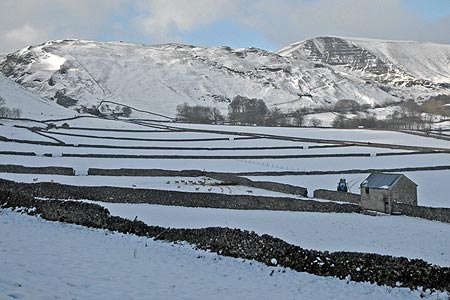
Click image to visit gallery of 9 images.
This circular Peak District walk starts from Castleton, which is a popular spot for tourists. There is a large pay and display car park adjacent to the Tourism Information Centre at grid ref. SK149829. There are plenty of opportunities for refreshment in the village either before you start the walk or after you have returned.
Exit the car park and turn left along Buxton Road and walk as far as the T-junction. Turn right here along Back Street which leads to the Market Place. Here bear right and continue along The Stones which leads directly into Goosehill. Towards the end of this lane take the signed footpath (grid ref. SK147826) bearing right towards Speedwell Cavern with the wall to your immediate right. This path climbs gently offering good views to your right of the Castleton Ridge.
Reaching the road by Speedwell Cavern (grid ref. SK139827), take the footpath almost opposite (just to your right). This leads through a field to a junction of paths (not too evident) where you turn right down to another road (grid ref. SK139826). Turn left along this road, which is the old main road to Buxton but now closed after the large landslip on the southern flank of Mam Tor. Continue along this road for just under a mile to reach the site of the landslip where an information board tells the story of what happened.
Continue to the end of the tarmac (grid ref. SK132829) where the old road bends sharply to the left. Take the signed footpath on the right and follow a track to Mam Farm. Stay on the track past the farm to the next house. Keep to the right of this property following the path across a number of fields to reach a complex junction of paths and track just to the east of Woodseats (grid ref. SK137842). Follow the track eastwards for a short way until you reach a no access sign. Here the path away from the track following a wall which should be immediately on your right to meet with one of the main paths leading up to the Castleton Ridge (grid ref. SK141841).
Turn right here and follow the clear track which leads into Hollowford Road and takes you into Castleton. Reaching the main road, go straight ahead to turn left into Buxton Road with the car park on your right.
Other walks nearby
| Walk 1688 | Old Dam & Sparrowpit from Mam Nick | moderate | 9.0 miles |
| Walk 1286 | Castleton Great Ridge & Mam Tor | moderate | 8.5 miles |
| Walk 2599 | Kinder Scout and Castleton Ridge from Hope | mod/hard | 13.5 miles |
| Walk 1706 | Win Hill from Hope | easy/mod | 6.5 miles |
| Walk 2522 | Rushup Edge & Edale from Mam Nick | moderate | 7.0 miles |
| Walk 1368 | Mam Tor, Upper Booth & Rushup Edge | moderate | 7.0 miles |
| Walk 1831 | Mam Tor & Hollins Cross from Mam Nick | easy | 3.0 miles |
| Walk 1080 | Shatton Moor and Offerton | easy/mod | 7.5 miles |
| Walk 1159 | Grindsbrook & Edale Head | moderate | 7.5 miles |
| Walk 1264 | Rushup Edge & Crowden Tower | moderate | 10.0 miles |
Recommended Books & eBooks
Walking in Derbyshire
 Walking guidebook to 60 circular day walks in Derbyshire and the Peak District. Includes the Derwent, Wye and Trent river valleys, near Derby, Matlock, Glossop, Bakewell and Ripley. Routes range from easy to moderate and are between 4 and 14km (2 to 10 miles). Walks focus on places of interest, from Stone Age forts to castles to grand estates.
More information
Walking in the Peak District - White Peak East
 Guidebook describing 42 half-day and day walks in the limestone landscapes of Derbyshire's White Peak, part of the Peak District National Park. One of two volumes, this book covers the east of the region, with potential bases including Bakewell, Eyam, Castleton, Birchover, Matlock and Wirksworth.
More information
Messaging & Social Media
Message Walking Britain and follow the latest news.

Mountain Weather
Stay safe on the mountains with detailed weather forecasts - for iOS devices or for Android devices.