Wayram To Fridaythorpe Circular
Yorkshire Wolds Walk
Region - Yorkshire Wolds
County/Area - East Yorkshire & North Yorkshire - Yorkshire Wolds
Author - Donald Morton
Length - 7.5 miles / 12.2 km Ascent - 800 feet / 242 metres
Time - 4 hours 30 minutes Grade - easy/mod
Walk Route Description
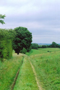
Click image to visit gallery of 5 images.
This walk explores the Yorkshire Wolds with the deep valleys typical of the area. The walk is described from the car park just off the A166 at grid reference SE835568 about 3 miles west of Fridaythoprpe.
With your back to the car park turn left and walk down the road immediately forking right onto a quiet road signed to Huggate. Follow this for rather more than 1 ½ miles over a crossroad and past a road coming in from the left to the drive for Wold House Farm. Turn left down the drive and follow it to the Georgian(?) farm complex. Here you need to turn left past an impressive array of cart sheds and then right to exit the farmyard and continue down what is now a gravel track. At a hedge the track turns left and quickly right to continue its previous direction. After going over a stile keep to the left to pass across the head of the attractive Holm Dale and join the Wolds Way as it goes straight on via another stile onto an enclosed track into Fridaythorpe.
Cross the A166 and turn right. At the bend in the A166 turn left up the road signed to Thixendale. The church is hidden down a green passage way on the right, and a little later at Church Lane keep left and just before the mill complex owned by ABN turn left down the Wolds Way. Follow the Way, which is well signposted, to a metal kissing gate and turn right through it to follow an old cart track down into Brubberdale. At the bottom go diagonally across and then continue on the Wolds Way up a small dale lined on the left with an avenue of trees. (Some have succumbed to age and at the start there is the remains of a bole which provides comfortable seating for at least two, probably four, picnickers.) At the top of the dale pass by Gills Farm on the left to arrive at a road (Grid ref. SE848593) still following the Wolds Way, which has been rerouted at this point.
Cross the road and continue straight on. The track turns left to descend into Grass Dale. At the bottom you leave the Wolds Way, which turns sharply right, and bear left to walk along the valley bottom of Bradeham Dale. (Ignore the bridleway going right.) After passing through a gate ignore the footpath coming in from the left and bear right, soon entering a wooded stretch. When the dale forks, follow the waymark round to the left hand branch. Come out of the woods at a gate and continue straight on up Wayram Dale to arrive at the A166. Cross diagonally right to find a footpath leading down to the car park.
Maps 

| Ordnance Survey Explorer 294 | Sheet Map | 1:25k | BUY |
| Anquet OS Explorer 294 | Digital Map | 1:25k | BUY |
| Ordnance Survey Digital Map Subscription | |||
| Latest Ordnance Survey Discounts | |||
Other walks nearby
| Walk 2703 | Thixendale & Kirby Underdale | easy/mod | 8.5 miles |
| Walk 3349 | Pasture Dale, Frendal Dale and Horsedale from Huggate | easy/mod | 9.1 miles |
| Walk 1779 | Horse Dale, Holm Dale, Tun Dale and Frendal Dale from Huggate | easy/mod | 9.0 miles |
| Walk 3127 | Bishop Wilton & Millington | moderate | 13.4 miles |
| Walk 3515 | Deepdale and the deserted village of Wharram St. Percy | easy | 5.0 miles |
| Walk 3434 | North Grimston, Birdsall & Wharram Percy | moderate | 12.1 miles |
| Walk 1738 | The deserted village of Wharram St Percy | easy | 2.7 miles |
| Walk 1990 | Settrington from North Grimston | easy/mod | 7.3 miles |
| Walk 1842 | Buttercrambe & Youlthorpe from Stamford Bridge | moderate | 11.8 miles |
| Walk 2727 | Pocklington Canal from Allerthorpe Wood | moderate | 11.0 miles |
