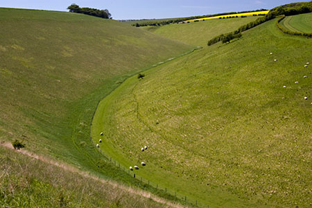
Horse Dale, Holm Dale, Tun Dale and Frendal Dale from Huggate
Yorkshire Wolds Walk
Region - Yorkshire Wolds
County/Area - East Yorkshire
Author - Lou Johnson
Length - 9.0 miles / 14.6 km Ascent - 1000 feet / 303 metres
Time - 5 hours 30 minutes Grade - easy/mod
Walk Route Description
Click image to see photo description.
A circular walk from Huggate exploring four dales in the Yorkshire Wolds. The route includes Horse Dale, Holm Dale, Tun Dale and Frendal Dale, which are dry valleys cut into the plateau. The walk follows sections of the Yorkshire Wolds Way and the Chalkland Way and provides an excellent introduction to this area. A similar shorter version of this walk can be found at Pasture Dale, Frendal Dale and Horsedale from Huggate.
The walk starts from the village of Huggate (grid ref. SE881554) where limited on street parking is available. However, do park carefully to avoid inconvenience for residents. After parking walk north through the village and continue along Town End Lane (Yorkshire Wolds Way) past the sewage plant on your right. Follow the lane as it bends to the right and pass the end of Cow Dale where the Chalkland Way descends right into the dale. Continue ahead up the lane for 800 metres passing through an avenue of trees. Turn left onto a bridleway at the fingerpost (grid ref. SE885566) and continue across the left-hand side of a field.
Continue to pass through a gate on the edge of Horse Dale. Follow the path descending half right into the dale to pass through a gate. Veer half left into Holme Dale, climbing gently to the head of the dale and a gate. Turn left onto a track and follow this through fields to Wold House Farm. Pass through the farm yards onto a track which is followed to York Lane (grid ref. SE858567). Turn right and continue to the next junction where you turn left onto a signed bridleway, which is part of the Chalkland Way.
The track enters woodland. After 200 metres keep right on a path (ignore bridleway which forks right). The path leaves the trees and crosses fields to join a track at the foot of Greenwick Dale (grid ref. SE850564). Turn left and continue through Tun Dale. You soon leave the trees and after a sharp right enter Frendal Dale. Walk the length of this dale to reach a road (grid ref. SE850545). Turn left and almost immediately go right through a gate to climb up the steep side of Pasture Dale. Descend into Nettle Dale and climb out of the dale again to a stile.
Cross the stile and turn left onto a track and continue to a road at Cobdale Cottage. Cross the road through a gate and onto a bridleway (Hawold Bridle Road). The track descends slowly over fields to reach Mill Lane at the head of Keasey Dale. Turn left and return to Huggate.
Maps 

| Ordnance Survey Explorer 294 | Sheet Map | 1:25k | BUY |
| Anquet OS Explorer 294 | Digital Map | 1:25k | BUY |
| Ordnance Survey Digital Map Subscription | |||
| Latest Ordnance Survey Discounts | |||
Other walks nearby
| Walk 2655 | Wayram To Fridaythorpe Circular | easy/mod | 7.5 miles |
| Walk 2906 | Circular from Wayrham Through Painsthorpe | moderate | 8.5 miles |
| Walk 2703 | Thixendale & Kirby Underdale | easy/mod | 8.5 miles |
| Walk 3127 | Bishop Wilton & Millington | moderate | 13.4 miles |
| Walk 3515 | Deepdale and the deserted village of Wharram St. Percy | easy | 5.0 miles |
| Walk 3434 | North Grimston, Birdsall & Wharram Percy | moderate | 12.1 miles |
| Walk 1738 | The deserted village of Wharram St Percy | easy | 2.7 miles |
| Walk 1990 | Settrington from North Grimston | easy/mod | 7.3 miles |
| Walk 3740 | Cowlam & Cottam Circular | easy/mod | 8.0 miles |
| Walk 2727 | Pocklington Canal from Allerthorpe Wood | moderate | 11.0 miles |
