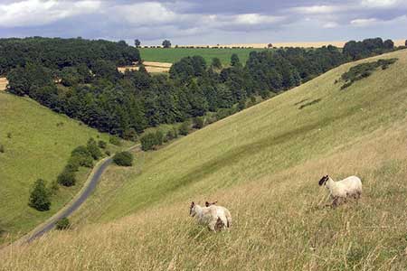
Pasture Dale, Frendal Dale and Horsedale from Huggate
Yorkshire Wolds Walk
Region - Yorkshire Wolds
County/Area - East Yorkshire - Yorkshire Wolds
Author - Lou Johnson
Length - 9.1 miles / 14.8 km Ascent - 900 feet / 273 metres
Time - 5 hours 30 minutes Grade - easy/mod
Walk Route Description
Click image to see photo description.
The Yorkshire Wolds in the East Riding of Yorkshire are often overlooked yet the area provides some excellent walking. Never spectacular, the dry valleys that are cut deep into the landscape provide interest with their gently rounded contours. The area is also relatively quiet and never seems to be overrun with visitors. A similar longer version of this walk can be found at Four Dales from Huggate.
The start is the village of Huggate (grid ref. SE881554) where on street parking is available. However, do be considerate of the local residents are park with courtesy. After parking walk north through the village passing the parish church on your right. Some 200 metres past the church bear left off the lane onto the Yorkshire Wolds Way. Follow this track past Glebe farm (on your right) and continue following the waymarked path to reach York Lane (grid ref. SE867557). Go straight across this lane and continue following the Yorkshire Wolds Way, which soon goes left and continues in a southerly direction to reach Pocklington Lane (grid ref. SE866548) at a road junction.
Ignore the lane to your right and left and continue following the waymarks onto Cobdale Lane. After a short distance the Yorkshire Wolds Way leaves the lane on your right. The path follows the southern rim of Pasture Dale before turning left and then right around the boundary of Jessop's Plantation. The way ahead descends, with Nettle dale to your right, to reach a path junction with the Chalkland Way (grid ref. SE849540). Turn right and continue along the Chalkland Way crossing a lane into Pasture Dale. The Chalkland Way continues a meandering course along Frendal Dale and Tun Dale to reach a road (grid ref. SE856568) after about two miles.
Turn right along the lane, remaining on the Chalkland Way. After 300 metres the Chalkland Way leaves the road on your left. Continue towards Wold House Far turning right as indicated by the Chalkland Way waymarks. Continue past a small plantation to reach a gate (grid ref. SE867561) with Horse Dale to your left. Horse Dale is Access Land and you should head along the southern rim of the Dale for about a mile to regain the Yorkshire Wolds Way at grid ref. SE882570. Turn south onto the YWW and follow it back into Huggate and your car.
Maps 

| Ordnance Survey Explorer 294 | Sheet Map | 1:25k | BUY |
| Anquet OS Explorer 294 | Digital Map | 1:25k | BUY |
| Ordnance Survey Digital Map Subscription | |||
| Latest Ordnance Survey Discounts | |||
Other walks nearby
| Walk 2655 | Wayram To Fridaythorpe Circular | easy/mod | 7.5 miles |
| Walk 2906 | Circular from Wayrham Through Painsthorpe | moderate | 8.5 miles |
| Walk 2703 | Thixendale & Kirby Underdale | easy/mod | 8.5 miles |
| Walk 3127 | Bishop Wilton & Millington | moderate | 13.4 miles |
| Walk 3515 | Deepdale and the deserted village of Wharram St. Percy | easy | 5.0 miles |
| Walk 3434 | North Grimston, Birdsall & Wharram Percy | moderate | 12.1 miles |
| Walk 1738 | The deserted village of Wharram St Percy | easy | 2.7 miles |
| Walk 1990 | Settrington from North Grimston | easy/mod | 7.3 miles |
| Walk 3740 | Cowlam & Cottam Circular | easy/mod | 8.0 miles |
| Walk 2727 | Pocklington Canal from Allerthorpe Wood | moderate | 11.0 miles |
