Hartington Walks and Walking Guide
Peak District, Derbyshire
Find circular walks from Hartington which lies at the northern end of Dovedale and is an ideal centre for walking in this part of the Peak District National Park. The village has a variety of cafés, bars and restaurants. Accommodation in the area is varied. Public transport is limited but does provide links to some of the walks in this beautiful area. Highlights include Dovedale, Chrome Hill and Lathkill Dale.
All walks are free to download and print, and includes mapping and GPX files. The routes range from circular family walks to longer full day hikes.
★ = GPS file available
| Walk | Description | Grade | Miles |
|---|---|---|---|
| 2681★ | Wetton & Manifold Valley from Wetton | easy/mod | 3.60 |
| 3046★ | Lathkill Dale & Monyash | easy | 4.00 |
| 1369★ | Tissington Trail - Hartington to Parsley Hey | easy | 4.00 |
| 1185★ | Chrome Hill (Dragon's Back) from Hollinsclough | easy/mod | 4.50 |
| 1021★ | Milldale & Hall Dale from Alstonefield | easy/mod | 5.00 |
| 1861★ | Chrome and Parkhouse Hills from Earl Sterndale | easy/mod | 5.00 |
| 1594★ | Biggin, Wolfscote & Beresford Dales from Hartington | easy | 5.50 |
| 1410★ | Minninglow Hill, Roystone Grange and Cardlemere Lane from Gotham | easy/mod | 5.50 |
| 1042★ | Pilsbury Castle from Hartington | easy/mod | 5.50 |
| 2682★ | River Dove & Reynard's Lane from Hartington | easy/mod | 5.60 |
| 1862★ | Earl Sterndale and High Wheeldon from Longnor | easy/mod | 6.00 |
| 1589★ | Lathkill & Bradford Dales (short version) from Back Lane | easy/mod | 6.00 |
| 1593★ | Beresford, Wolfscote & Biggin Dales from Hartington | easy/mod | 6.20 |
| 1181★ | Wetton Hill & the Manifold Valley from Wetton | easy/mod | 6.50 |
| 1709★ | Milldale and Wolfscote Dale from Alstonefield | easy/mod | 6.50 |
| 2837★ | Parkhouse & Chrome Hills from Longnor | easy/mod | 6.70 |
| 1595★ | Dove Valley & Biggin Dale from Hartington | easy/mod | 6.80 |
| 2537★ | Ecton Hill & Wetton from Wetton Mill | moderate | 7.00 |
| 2079★ | Beresford & Wolfescote Dales from Hartington | easy/mod | 7.20 |
| 1257★ | Wolfscote Dale from Alstonefield | easy/mod | 7.50 |
| 2531★ | Upper Dove Valley from Hollinsclough | moderate | 7.50 |
| 1653★ | The Manifold Valley from Wetton | easy/mod | 7.80 |
| 1569★ | Lathkill Dale & Bradford Dale from Back Lane | easy/mod | 8.20 |
| 1590★ | Monyash & Lathkill Dale from Back Lane | easy/mod | 8.20 |
| 2545★ | High Edge & Chrome Hill from Hollinsclough | moderate | 8.50 |
| 2301★ | Biggin & Parsley Hay from Hartington | easy/mod | 9.50 |
| 2723★ | Pilsbury Castle, Hartington & Sheen from Longnor | easy/mod | 9.60 |
| 3601★ | Dove & Manifold Valleys from Alstonefield | moderate | 10.00 |
| 3597★ | Manifold Valley, Thor's Cave, Ecton & Wetton Hills from Alstonefield | moderate | 10.00 |
| 1146★ | Bradford & Lathkill Dales from Monyash | moderate | 11.25 |
The walks listed above are the nearest 30 from Hartington when measured in a straight line.
Recommended Reading
Walking in the Peak District - White Peak East
 Guidebook describing 42 half-day and day walks in the limestone landscapes of Derbyshire's White Peak, part of the Peak District National Park. One of two volumes, this book covers the east of the region, with potential bases including Bakewell, Eyam, Castleton, Birchover, Matlock and Wirksworth.
More information
Walking in Derbyshire
 Walking guidebook to 60 circular day walks in Derbyshire and the Peak District. Includes the Derwent, Wye and Trent river valleys, near Derby, Matlock, Glossop, Bakewell and Ripley. Routes range from easy to moderate and are between 4 and 14km (2 to 10 miles). Walks focus on places of interest, from Stone Age forts to castles to grand estates.
More information
Further Information
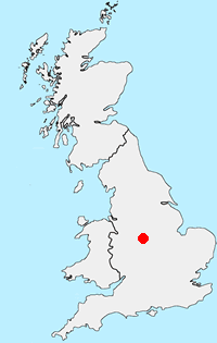
Walk Location Map
Walking in Peak District
Walking in the Peak District is some of finest in the UK. The National Park suffers from a split personality with its contrasting White and Dark Peaks. Within easy distance from Manchester, Sheffield and the Midlands there is much for the visitor to see. The contrast between quiet limestone dales and wild upland moors provides the basis for a diverse range of Peak District walks with scenic variety the keynote. More Information
Walk grading - Learn how each walk is assessed and select a walk to suit your ability and experience by going to Walk Grading Details.
Messaging & Social Media
Message Walking Britain and follow the latest news.

Mountain Weather
Stay safe on the mountains with detailed weather forecasts - for iOS devices or for Android devices.