Cheshire WalksWalking Routes & Hiking Trails
Find Cheshire walks from the list below which features the best walking routes in the area. Most are circular walks and are listed from the shortest and easiest to the longest more challenging routes.
| Walk | Description | Grade | Miles |
|---|---|---|---|
| 1461★ | Shutlingsloe from Trentabank | easy/mod | 3.00 |
| 3535★ | River Dee from Farndon | easy | 4.00 |
| 2749★ | Croker Hill Circular | easy | 4.00 |
| 2329★ | The Disley Lanes from Lyme Park | easy | 4.00 |
| 2480★ | Siddington & Redes Mere Circular | easy | 4.20 |
| 2605 | White Nancy & Saddle of Kerridge Nr Bollington | easy | 4.50 |
| 1652★ | Three Shires Head from Danebower Hollow | easy | 4.50 |
| 2523★ | Black Rocks & Bollinhurst Reservoir from Disley | easy | 5.00 |
| 3588★☩ | Rainow Circular | easy/mod | 5.50 |
| 2567★ | Lyme Park & Dissop Head from Disley | easy | 6.00 |
| 2233★ | Flash & Three Shires Head from Danebower Hollow | easy/mod | 6.20 |
| 1481★ | Dale Top (Park Moor) from Lyme Park | easy | 6.25 |
| 1699★ | Mow Cop Circular | easy/mod | 6.40 |
| 2578 | Cheshire Lanes and Woodhouse Hill Fort | easy/mod | 7.00 |
| 2535★ | Wildboarclough & Shutlingsloe from Trentabank | moderate | 7.00 |
| 1728★ | Axe Edge Moor & Three Shires Head from Derbyshire Bridge | easy/mod | 7.20 |
| 1474★ | Park Moor and Birchencliff from Lyme Park | easy/mod | 7.25 |
| 1233★ | Shining Tor & Windgather Rocks from Lamaload | moderate | 7.50 |
| 2506★ | Tegg's Nose from Trentabank | moderate | 7.50 |
| 2528★ | Kettleshulme & Sponds Hill | moderate | 8.00 |
| 1502★ | Shutlingsloe and Macclesfield Forest from Trentabank | moderate | 9.00 |
| 1183★ | Shining Tor & Axe Edge Moor from Cat & Fiddle | moderate | 9.00 |
| 2557★ | Lyme Park from Poynton | moderate | 10.00 |
| 2527★ | Kettleshulme & Taxal Edge from Lamaload | moderate | 10.00 |
| 1371★ | Rossendale Ramble from Sutton | moderate | 12.00 |
| 2512 | Acton Bridge, Woodhouse Hill & the River Weaver | moderate | 13.00 |
Walks that start in adjacent counties / areas.
Walks that start in adjacent counties or areas but cross the boundary and include sections of the route within Cheshire.
| Walk | Description | Starts In |
|---|---|---|
| 3510★ | Shining Tor, Cats Tor & Foxlow Edge | Derbyshire |
| 1092★ | Taxal Edge, Jenkin Chapel & Pym Chair | Derbyshire |
| 3136★ | Shining Tor & Goyt's Clough | Derbyshire |
| 3323★ | Gradbach, Three Shires Head & Knotbury | Staffordshire |
| 3197★ | Flash, Knotbury & Three Shires Head | Staffordshire |
★ GPS file ☩ Route profile
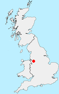
Location Map
Cheshire Guide
The County of Cheshire offers a range of walks to suit all abilities. The Sandstone hills between Frodsham and Helsby offer fine walks with some excellent views across the Mersey Estuary. The flat land of the Cheshire Gap is dominated by pleasant rural farmland and easy walking. To the east of the county the land rises to the western moors of the Peak District National Park including the highest point at Shining Tor (559 metres) on the boundary with Derbyshire. It is in this area that most of the more challenging walks can be found with wild country and superb panoramas from the high ground.
Other walks in Britain - For a list of all the areas where walks are available go to the Main Walk Index.
Walk grading - Learn how each walk is assessed and select a walk to suit your ability and experience by going to Walk Grading Details.
Messaging & Social Media
Message Walking Britain and follow the latest news.

Mountain Weather
Stay safe on the mountains with detailed weather forecasts - for iOS devices or for Android devices.