Cornwall AONB WalksWalking Routes & Hiking Trails
Find Cornwall AONB walks from the list below which features the best walking routes in the area. Most are circular walks and are listed from the shortest and easiest to the longest more challenging routes.
| Walk | Description | Grade | Miles |
|---|---|---|---|
| 1224★ | Men-an-tol & Ding Dong Mine from Bosullow | easy | 3.00 |
| 2010★ | Housel Bay & Bass Point from the Lizard | easy | 3.50 |
| 2088★ | Rosemullion Head & Mawnan | easy | 4.00 |
| 1808★ | Brown Willy, exploring Cornwall's highest Tors | easy/mod | 4.00 |
| 2462★ | The Rumps & Pentire Point | easy/mod | 4.00 |
| 3325★ | Chun Quoit & Carn Kenidjack | easy | 4.00 |
| 2354★ | Merry Maidens & Lamorna Cove | easy | 4.10 |
| 2001★ | Coverack & Lowland Point | easy/mod | 4.20 |
| 1031★ | Polruan & Lanteglos Church from Pencarrow | easy/mod | 4.25 |
| 2009★ | Gillan & Nare Point from Porthallow | easy | 4.70 |
| 2298★ | Porthgwarra & St Levan Circular | easy | 4.80 |
| 1783★ | Gorran Haven & Dodman Point | easy/mod | 5.00 |
| 2247★ | Draynes Bridge & Siblyback Lake | easy/mod | 5.00 |
| 2294★ | St. Agnes to Porthtowan | easy/mod | 5.00 |
| 2267★ | Godrevy Point & Hell's Mouth | easy/mod | 5.20 |
| 1223★ | Morvah to Zennor coast | moderate | 5.50 |
| 3606★ | Berry Down from St Neot | easy/mod | 5.60 |
| 3264★ | Port Quin & Port Isaac Circular | easy/mod | 5.70 |
| 2392★ | The Lizard Circular from Kynance Cove | easy/mod | 5.90 |
| 3755★ | Dizzard Point, Millook from Penhalt Cliff | moderate | 6.00 |
| 1226★ | Land's End & Sennen Cove from Porthcurno | moderate | 6.50 |
| 1027★ | Nare Head & Portloe from Veryan | moderate | 7.00 |
| 2007★ | Helford Passage & Frenchman's Creek | easy/mod | 7.00 |
| 1225★ | Sennen Cove & Botallack from St Just | moderate | 7.50 |
| 1028★ | Chun Quoit and Botallack from Carnyorth | moderate | 8.00 |
| 1030★ | Fowey & Gribbin Head from Polkerris | moderate | 8.00 |
| 1076★ | Dizzard Point & Crackington Haven from near Treskinnick Cross | moderate | 8.00 |
| 1032★ | Kynance Cove, Cadgwith & The Lizard | moderate | 8.00 |
| 1778★ | Maenporth and Helford Passage Circular | easy/mod | 8.00 |
| 1547★ | Trevose Head & Constantine Bay from Porthcothan | easy/mod | 8.50 |
| 2342★ | Gribbin Head & Polkerris from Polruan | moderate | 8.50 |
| 2614★ | St Loy's Cove & Logan Rock | moderate | 8.50 |
| 1029★ | Tintagel to Boscastle | moderate | 9.00 |
| 2003★ | Cowlands, Coombe & Roundwood Quay from Trelissick | easy/mod | 9.00 |
| 1878★ | Poldhu Cove to Lizard Point | moderate | 9.50 |
| 3279★ | Tors of Bodmin Moor | moderate | 10.00 |
| 1104★ | Newquay to Porthcothan coast path | moderate | 10.50 |
| 3501★ | Penzance to Porthcurno via Mousehole and Lamorna | moderate | 11.00 |
| 1033★ | Dodman Point & Gorran Haven from Caerhays | mod/hard | 11.00 |
| 1081★ | Zennor & St Ives coast path | mod/hard | 11.00 |
| 3738★ | Polzeath & Pentire Point from Rock | moderate | 11.40 |
| 2616★ | The moors and hills of Penwith | moderate | 14.00 |
★ GPS file ☩ Route profile
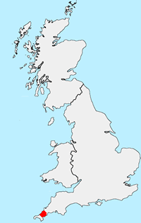
Location Map
Cornwall AONB Guide
This National Landscape (formerly AONB) is split into many small fragments. It contains some of Britain's finest coastal scenery, including Land's End and the Lizard peninsula. In addition Cornwall's highest moorland around Bodmin is also included in this very varied and historically interesting area.
Cornwall-AONB Walking Guide
Other walks in Britain - For a list of all the areas where walks are available go to the Main Walk Index.
Walk grading - Learn how each walk is assessed and select a walk to suit your ability and experience by going to Walk Grading Details.
Messaging & Social Media
Message Walking Britain and follow the latest news.

Mountain Weather
Stay safe on the mountains with detailed weather forecasts - for iOS devices or for Android devices.