Ceredigion WalksWalking Routes & Hiking Trails
Find Ceredigion walks from the list below which features the best walking routes in the area. Most are circular walks and are listed from the shortest and easiest to the longest more challenging routes.
The Ceredigion walks listed below allow you to explore this scenically varied area. Highlights include the often-dramatic coast with the Wales Coast Path providing excellent access. Inland the wild open country and high ground around Plynlimon, the highest point in the county, offers more challenging walks with wide ranging views. All the walks are free to download and print, and all routes have GPS files.
| Walk | Description | Grade | Miles |
|---|---|---|---|
| 2250★ | Penbryn & Tresaith | easy/mod | 3.50 |
| 1361★ | Tregaron & Twm Town circular | easy | 3.50 |
| 1362 | Tregaron & Cors Caron circular | easy | 4.00 |
| 3493★☩ | Llangrannog Circular | easy/mod | 4.50 |
| 1705★ | Bont-goch Circular from near Aberystwyth | easy/mod | 4.50 |
| 1364★ | Tregaron & Llandewi Brefi circular | easy/mod | 4.50 |
| 2138★ | Plynlimon Circular from Eisteddfa Gurig | moderate | 5.00 |
| 1304★ | Plynlimon from Esteddfa Gurig | moderate | 5.00 |
| 2193★ | Penbryn & Llangrannog Circular | easy/mod | 5.40 |
| 1363★ | The Elephant Walk from Tregaron | easy/mod | 5.50 |
| 3429★ | Byrlip and Ceredigion Coast Path from New Quay | easy/mod | 5.70 |
| 1767★ | Allt Wen & Wales Coast Path from Trefechan | easy/mod | 6.00 |
| 3492★☩ | Trwyn Crou from Cwmtydu | moderate | 6.10 |
| 1420 | Borth to Aberystwyth coast | easy/mod | 6.50 |
| 3086★ | Pen y Garn from near Devil's Bridge | easy/mod | 6.80 |
| 2656★ | New Quay to Cwmtydu using the coastal path | moderate | 8.00 |
| 1366★ | Pentre Bach circular from near Tregaron | easy/mod | 9.50 |
| 1365★ | Strata Florida to Tregaron | moderate | 9.50 |
| 2048★ | Craig-y-Pistyll, Cambrian Mountains | moderate | 10.00 |
| 1367★ | Cwm Berwyn from Tregaron | moderate | 11.00 |
| 1102★ | Plynlimon & Nant-y-Moch Reservoir from Esteddfa Gurig | hard | 11.00 |
★ GPS file ☩ Route profile
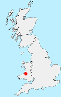
Location Map
Ceredigion Guide
Ceredigion is a coastal county in mid-Wales. The Cambrian Mountains covering much of the east of the county and offer excellent walking. The highest point is Plynlimon at 2,467 feet (752 m). In complete contrast to the wilds of the mountains, Ceredigion's 50 miles (80 km) of coastline has sandy beaches and, in places, high cliffs. Several attractive seaside resorts provide excellent bases for exploration. The Wales Coast Path follows the full length of the coast.
Other walks in Britain - For a list of all the areas where walks are available go to the Main Walk Index.
Walk grading - Learn how each walk is assessed and select a walk to suit your ability and experience by going to Walk Grading Details.
Messaging & Social Media
Message Walking Britain and follow the latest news.

Mountain Weather
Stay safe on the mountains with detailed weather forecasts - for iOS devices or for Android devices.