Dumfries and Galloway WalksWalking Routes & Hiking Trails
Find Dumfries and Galloway walks from the list below which features the best walking routes in the area. Most are circular walks and are listed from the shortest and easiest to the longest more challenging routes.
Walking in Dumfries and Galloway is dictated by the geography of the area. The coast. Including along the Solway Firth, offers a variety of scenic walks. The hills, including Merrick, White Coomb and Hart Fell, offer excellent and sometimes challenging routes. All walks are free to print and download. All routes include GPS files.
| Walk | Description | Grade | Miles |
|---|---|---|---|
| 2658★ | The Machars Peninsula - St Ninian's Cave | easy | 2.00 |
| 3316★ | Rockcliffe to Kippford | easy | 3.00 |
| 3290★ | Rockcliffe to Sandyhills | easy/mod | 5.00 |
| 2045★☩ | Capel Fell via Sailfoot Law & Broken Back Hill | moderate | 5.80 |
| 1718★ | Mull of Galloway circular | easy | 6.00 |
| 2068★ | Maxwell's Otter and Monreith Beach | easy | 6.00 |
| 2004★ | Calfield Rig & Mid Hill from Langholm | easy/mod | 6.70 |
| 2035★☩ | Hart Fell via Hartfell Spa | moderate | 7.20 |
| 2006★☩ | Grey Mare's Tail & White Coomb | mod/hard | 7.20 |
| 2623★☩ | Merrick from Glen Trool | mod/hard | 8.00 |
| 2280★☩ | Hart Fell & Whitehope Heights from Annan Water | moderate | 8.40 |
| 2008★☩ | Hart Fell via Saddle Yoke & the Black Hope Horseshoe | mod/hard | 8.50 |
| 2050★☩ | The Crown of Scotland | moderate | 9.00 |
| 2268★☩ | Annandale Way from Devil's Beef Tub | moderate | 9.00 |
Walks that start in adjacent counties / areas.
Walks that start in adjacent counties or areas but cross the boundary and include sections of the route within Dumfries and Galloway.
| Walk | Description | Starts In |
|---|---|---|
| 3612★☩ | Ettrick Hills Horseshoe | Scottish Borders |
★ GPS file ☩ Route profile
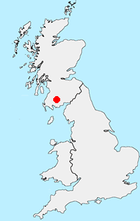
Location Map
Dumfries and Galloway Guide
Dumfries and Galloway is located in south-west Scotland and shares a short border with England. The area has a lengthy coastline including along the Solway Firth. Inland there are ranges of hills including Merrick the highest hill rising to 843 metres above sea level. Long distance footpaths include the Southern Upland Way.
Other walks in Britain - For a list of all the areas where walks are available go to the Main Walk Index.
Walk grading - Learn how each walk is assessed and select a walk to suit your ability and experience by going to Walk Grading Details.
Messaging & Social Media
Message Walking Britain and follow the latest news.

Mountain Weather
Stay safe on the mountains with detailed weather forecasts - for iOS devices or for Android devices.